

IJC updates Lake Superior Outflows and Expected Conditions – July 2020
July 23, 2020
Basin conditions were generally near average or drier than average in June, around both Lake Superior and Lake Michigan-Huron. As a result, water levels did not rise as much as they typically do in June.
Nonetheless, water levels are expected to remain high over at least the next few months and further record-highs are possible if wet conditions return. Furthermore, there will continue to be a significantly increased risk of shoreline erosion, lakeshore flooding and coastal damages as high water levels persist. The International Lake Superior Board of Control (Board) advises all those that may be affected to prepare for potentially severe coastal impacts, especially during periods of strong winds and high waves.
Lake Superior rose 5 cm over the course of the month, while on average the water level rises 8 cm in June. At the beginning of July, Lake Superior is 13 cm below the record-high beginning-of-month level set last year in 2019. The level is currently 23 cm above average (1918 – 2019).
Lake Michigan-Huron rose 2 cm over the course of the month, while on average the water level rises 6 cm in June. At the beginning of July, Lake Michigan-Huron is 10 cm above the previous record-high beginning-of-month level set last year in 2019. The level is currently 88 cm above average.
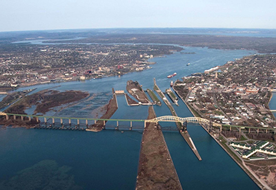
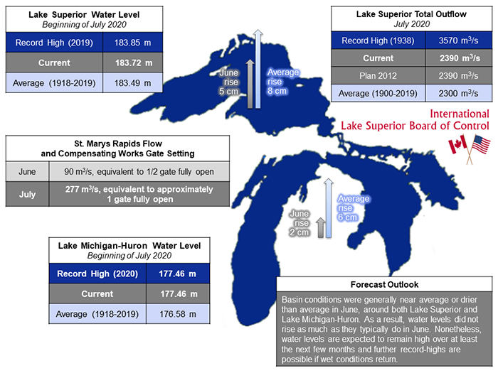 The Board expects the total outflow to be 2,390 m3/s in July, which is as prescribed by Lake Superior Regulation Plan 2012. Actual outflows may vary depending on hydrologic conditions, as well as maintenance activities at the hydropower plants on the St. Marys River. The outflow in July is just 90 m3/s above average and the lowest July outflow since 2013, which is in part a reflection of Plan 2012 adjusting to the relatively wetter conditions and higher levels experienced on Lake Michigan-Huron in comparison to Lake Superior in recent months.
In order to meet the Plan 2012-prescribed flow in July, the gate setting of the control structure will be adjusted to the equivalent of approximately one gate fully open. The average St. Marys Rapids flow is expected to be 277 m3/s. Gate configurations will be adjusted starting on Monday, 6 July, when Gates #11 through #14 will be raised to a setting of 98 cm open and Gates #9 and #10 will be closed. On Tuesday, 7 July, Gates #7 and #8 will be closed.
This gate configuration will allow safe diving conditions for underwater safety inspections of Gates #1 through #8 that are expected to be conducted in late July. Until the underwater inspections, there will be no change to the setting of Gate #1, which supplies a flow of about 15 m3/s to the channel north of the Fishery Remedial Dike.
Shoreline businesses and property owners are reminded that the Great Lakes – St. Lawrence River Adaptive Management (GLAM) Committee continues to host an online questionnaire to allow for direct reporting on impacts related to recent high water conditions. The 2020 version of the questionnaire is now available.