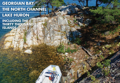
Planning a Cruise with PORTS Cruising Guide
 By Rob MacLeod, the InformedBoater
After decades of perusing charts and guidebooks as part of planning a cruise, it was a totally different experience editing PORTS Cruising Guide Georgian Bay, The North Channel and Lake Huron. My copy of PORTS Lake Ontario and Thousand Islands is dog-eared and well worn. That is how it is supposed to look after a few summers of use. If you have one that is still pristine itÕs time to get off the dock and put your PORTS Guide to good use.
Mary and I have a process for planning a cruise. It actually starts well in advance while the boat is laid up for winter. Starting right after the New Year about boat show time, we start blocking out our cruising plans for the summer. Nothing too detailed mainly blocks of time and general geographic areas.
By spring, we have a more formatted plan of what we would like to do or not do ? and where we plan to cruise for the summer. We estimate when we might need to take a dock to re-fuel, catch up on laundry, shopping, etc. Closer to the date, we look at long range weather to get the feel for general weather patterns and when we may need to seek a more sheltered anchorage or mooring ball. And before you know it, it is time to cast off.
 Figure 2: Aerial Chart from PORTS Georgian Bay.
While cruising, each evening we both review the charts and read the section of the PORTS Guide for the area we will be sailing, as well as any alternate routes we may consider. For instance, just crossing Kingston Harbour heading for the 1000 Islands presents a couple of reasonable alternative routes, depending on wind direction, wave height and anticipated weather.
We can choose the Bateau Channel and motor most of the day or, if the wind is favourable, we may choose to head south of Howe Island in the more open water of the east end of Lake Ontario into the St Lawrence River. Summer in southern Ontario can have some windless days and some great sailing as well.
As we arrive in the islands, we often make our first anchorage at the more popular Beaurivage Island, but our preference is a quiet, less crowded anchorage further into the 1000 Islands such as between Collier and Ninette Islands. (Aerial photo P 277).
Although close to a somewhat busy channel, the anchorage is quiet at night and just down the channel is the Glen House Resort a great place to meet friends and family or to have a meal and a pint in their pub.
You will notice in the PORTS text description the reference to the weedy bottom and the busy channel (especially on weekends). This is good to know when planning a visit. We usually choose mid-week for this anchorage.
Lets look at the planning process from conception to execution using PORTS Cruising Guides and appropriate charts ? electronic and paper.
Cruise Planning
1. Create an overview of your intended cruising area.
2. Determine how long you will be cruising? a weekend, a week or several weeks.
3. Determine the cruising range of your boat in hours, rather than in distance.
In your engine manual, there should be a fuel consumption chart that allows you to calculate how much fuel you will use while motoring on those windless days.
This chart for a Yanmar 4JH3E shows that at max revolutions (3800 RPM), fuel consumption will be about 3.25 gallons or just over 12 liters per hour, while at 80% or 3000 RPM, consumption will drop by half to 1.5 gph or 6 lph. If your boat has a 50-gallon/190 litre fuel tank, that will give you approximately 32 hours of cruising (50 gal/1.5 gph or 190 l/6 lph). Following the practice of never going below a quarter tank, you would have just over 24 hours motoring before re-fueling.
[Callout] Cruising isn’t just about moving the boat. It is also about what to do at each stop or anchorage. While editing the 30,000 Island section of PORTS, Mary and I hatched a plan to put our RIB on the trailer and drive to a place we cannot take our 36-foot sailboat with a 5-foot draft? the area around Byng Inlet on Georgian Bay. The idea of renting a cabin or staying at a lodge and gunkholing the islands and bays of the area fed our boating dreams and warmed our winter souls for a couple of weeks. Armchair cruising can be the right tonic for long winter evenings.

Figure 3: Map Anchorage Ninette Island.
4. Use the distance chart in the front of the PORTS Guide to determine the distance for each leg of your cruise. Divide the distance (say Picton to Waupoos) by the average speed you can maintain at your chosen RPM. So, for a distance of 31 nautical miles and a boat speed of 5.5 knots, the running time under engine alone is 5.7 hours (31 NM/5.5 knots). On Sojourn we track the engine hour meter and track our refueling in our ship’s log.
5. Using a mobile app like Navionics allows for quick planning and multiple revisions. On this leg of the cruise to the 1000 Islands, we plan to depart Collins Bay and pass through Kingston Harbour and the Bateau Channel to Beaurivage Island a distance of 22.2 NM taking 4 hours at our cruising rpm and consuming 0.6 gph of fuel ? 2.4 gallons.
6. We then read the PORTS Guide looking for hazards along our route and for convenient stopping places, should the weather turn bad or we just don’t feel like doing the entire distance in one day. This is when we also go online to get the latest water depth information from waterlevels.gc.ca.

Figure 5: Fuel Consumption Chart.
7. The morning of the cruise, we review our chartwork, the guide, water levels, Notice to Mariners (marinfo.gc.ca) and transfer the course we set out to our primary chart plotter. Now we have 2 copies of our plan, one on the tablet and one on the plotter.
8. The PORTS Guide is never far from the helm as we make our way, just in case something crops up that we had not considered.
9. Finally, before coming into our destination, Mary and I both re-read the guide looking again for any hazards or notes we missed or forgot (and we find those on a regular basis.) If it is a particularly tricky or complex approach, one of us will read the guide out loud to the person on the helm as we progress.
10. We then finish by making notes in the guide for the next time we come that way.
 Figure 6: Fuel Log.
In closing, I thought I would look at the difference between the PORTS Guide intended for small craft navigation and the Sailing Directions, published by Fisheries and Oceans. The Sailing Directions is intended for commercial shipping and does not cover the small craft routes that PORTS covers. PORTS does not cover the commercial routes you see on charts especially on the Great Lakes. So, if you are staying within the small craft areas, the Sailing Directions is not as necessary. However, as we cruisers get more adventurous, we will wander out into open water and enter the realm of larger commercial vessels. Although the cost of the Sailing Directions is reasonable, (9.95 to 19.95 depending on the area covered) they are now available as a no-charge PDF download that works on a tablet.
In Summary
Start your summer cruising by reviewing the PORTS Guide:
1. Review the first section of the guide Especially the BORDER CROSSING information that has been updated to reflect the changes in processes for both US and Canadian (i.e. Phasing out of OARS and the introduction of ROAM (US) and the phasing out of CANPASS and the leveraging of Telephone Reporting Site-Marine (TRS/M).
 Figure 7: Picton to Waupoos.
2. USING THE CHARTS will supply you and your crew with all of the paper charts needed to safely navigate the area Canada and US.
3. GOING THE DISTANCE is valuable for cruise planning
4. DEPTH PERCEPTIONS guides through the transition from Imperial based charts (Fathoms and Feet) to Metric (metres) depths.
5. SECURING details different methods of securing your boat by anchor, mooring and docking (floating and fixed) along with several sections of cruising information distributed through the PORTS Guide.
Figure 8: Collins Bay 1000 Islands.
 Finally, I cannot express enough how important an up-to-date cruising guide is in planning and executing a safe and fun cruise. Read and re-read the information in each guide gleaned from boaters who went before us. Continue to grow your understanding and skills. Be careful taking short cuts unless you have a great deal of local knowledge. Keep your PORTS Cruising Guide up to date by registering online. The registration card is in you 2020 Ports Guide. CY Media will update the Guide every 3 years to continue to support your cruising experience.
Figure 9: CEN302E Cover. (left)

Figure 10: CEN302 Map. (right)