Cuba Welcomes U.S. Boaters and Cruisers; NV Charts Launches Complete, Up-to-date Cuba Chart Atlas Series
American cruisers, sailors, and boaters wanting to visit Cuba can now travel in confidence using new and updated chart sets for the entire Cuban coastline. NV Charts, a leading provider of charting products for navigation, announces the release of all four (4) Cuba chart sets in NV Charts’ new and popular Atlas style format.
“Recently, the U.S. Government issued new rules regarding travel to Cuba,” states HaskoScheidt, NV Charts’ CEO. “This is a momentous step forward for the boating industry, because now, persons travelling to Cuba can sail there on their own vessels, and with others. Our completely new Cuba charts in paper and digital format will help recreational boaters or charterers explore the coast of Cuba in safety and with confidence.”
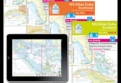
NV Charts’ four regions 10.1 through 10.4 cover the four quadrants of the Cuban coast, Northeast, Northwest, Southwest, and Southeast, and include harbor and anchorage details. The new Cuba chart atlases are sold as ‘Combi-packs’; each one of the four contains all of the information for that area, and is priced at $99.80 USD. Each release is up-to-date and meticulously surveyed. NV Charts are relied on for accuracy and dependability by recreational boaters, professional mariners, and the US Coast Guard. The chart regions include the download of digital charts as well as free digital navigation software and the free NV Charts Mobile App for iOS/ OS X and Android devices.
The new NV Charts atlases for Cuba now feature a compact, fold-over Atlas format (‘booklet’ style) that reduces the physical size of the paper chart set by half (but not the cartography itself) for ease of use on today’s smaller navigation stations and chart tables. “Since these charts are produced from our own cartographic databases, rather than simply copied from government sources, we have designed them so that no critical elements are in the crease, or fold, where they might lose definition over time from use and wear,” Hasko adds.
NV Charts produces charting products for the entire US East Coast from the Canadian border to the Florida Keys, as well as comprehensive charts of the Caribbean. NV Charts offers approximately 4,000 charts and more than 2,000 details and harbor plans. These charts are designed with the prudent mariner in mind; coasts and anchorages are regularly updated through new surveys and aerials.
NV Charts are available in paper, digital format for use on PCs, downloadable online, and for use with NV Charts’ free App for navigation with all iOS and Android mobile devices. NV Charts in all available formats can be easily purchased at www.nvcharts.com.