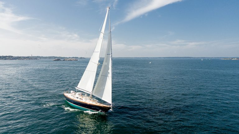
The iPad Onboard
Overnight, the iPad is revolutionizing the field of marine electronics. It offers versatility for charting, navigation and cruise planning, and there’s a fast-growing world of choice in practical helmside apps.
Nautical software apps on the iPad are the big news in marine electronics this year. A full range of apps for use onboard is available, covering navigation, tide and current data, AIS reporting, cruising guides, reference books and more. Capabilities once costing hundreds of dollars for navigation software on the PC are now about $50 on the Apple App Store.
But sometimes the apps seem too good to be true. In this article, we’ll consider the following questions: Is the iPad safe to use for navigation? Can it be used for AIS reception? Does it work when you’re away from an Internet connection? Most importantly, should you carry one on your boat?
Navigation Capability
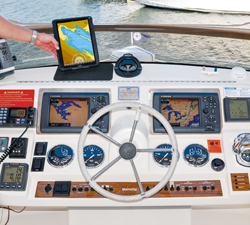
The large, high-resolution touch-screen of the iPad rivals chartplotters and multi-function displays costing thousands of dollars. The versatility of the iPad for use on a boat is truly remarkable and the price of the nautical apps is very tempting compared to typical marine electronics. But as with any tool, it is important to understand the true capabilities and limitations of nautical apps available for the iPad.
At the top of the list of iPad capabilities is navigation and there are a number of good apps available for purchase. How do you choose? A good approach is to start with the navigation charting display you are most comfortable with. If your current plotter uses Navionics chart data, you may be best served by purchasing the Navionics Marine and Lakes: US and Canada HD app for about $55 in the Apple App Store. If your plotter uses Jeppesen C-Map chart data, you may be interested in the Jeppesen Marine Plan2Nav. The program is free, but chart data for different areas is an additional $19.99 to $29.99.
Then there are programs such as the new Garmin BlueChart Mobile, also free, with the option to pay for specific chart regions such as North America at $44.99. This program is designed as a planning tool. When under way, it is limited to showing you the position of your vessel but will not display your planned routes. To show the route line, you upload the information to one of several of Garmin’s best- selling plotters using a special Wi-Fi adapter.
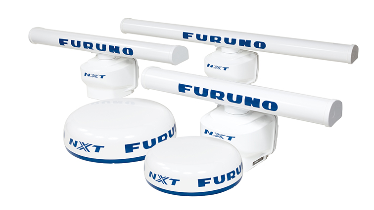
New iPad apps are available from Raymarine, Furuno and Simrad, but instead of being fully functional nav apps they are repeaters and viewers of the information on compatible plotters and MFDs from their respective manufacturers. They are designed to leverage the superior reception of an installed nav system – an interesting option that extends the versatility of your chartplotter by allowing a wireless repeater virtually anywhere on the boat.
Several other low-cost charting programs are available for the iPad and iPhone. Make sure they support Canadian Hydrographic Services (CHS) charts or other chart data for Canada. Many are designed exclusively for use with the free chart data available from the US government.
With a confusing set of alternatives, how do you choose? Start by defining whether you would like a full navigation program, a chart viewer, or a repeater compatible with your existing nav system.
Nav Apps
Let’s take a look at a few of the apps available and their capabilities:
iNavX is a comprehensive navigation package for the iPad from a company that is not a household name. Richard Ray is the developer behind iNavX and he is passionate about his software. When Apple updates iOS, Ray follows suit just a few days later with his own software update. If you have a problem, an email to Richard typically elicits a response within a day.
Want a fully integrated system in your boat? Connect one of the third-party wireless NMEA multiplexers available and all of your NMEA data can flow through your iPad and be displayed in the iNavX app. You can even control the boat’s autopilot from iNavX if you like. NOAA charts for the US are free but Canadian CHS chartpacks and Navionics charts (including Canadian coverage) require an additional purchase from Fugawi X-Traverse, a Toronto-based online marketer of chart data.
Navionics released their first app for the iPhone almost four years ago and now boasts hundreds of thousands of users. It offers typical Navionics quality and is a welcome addition if you already have a chartplotter on your boat with their charts. The base program for the iPad is $55. The purchase price includes the ability to download an extensive range of vector chart data for both Canada and the US in case you need it. It also includes access to pictures and magazine articles geo-referenced to marinas and other destinations, as well as wind and weather data. This data, accessed via an Internet connection, is best used for trip planning if your passage will take you to remote locations without cell or Wi-Fi coverage.
Navionics has made steady improvements and this year filled critical product gaps with an in-app purchase of $4.99 for a module that allows extensive route planning while cruising.
The Navionics app is not perfect. Periodically it crashes and the feature set does not reach the same level of PC and Mac-based navigation programs. For example, there is no indication of GPS signal strength or integrity. Several times last season, I lost the GPS satellite signal on my iPad without any notification. The track continued in an arcing turn toward the rocks and over land, even though we continued in a straight line. ! In limited visibility, this would be very disconcerting if you were relying solely on your iPad.
If your existing chartplotter uses C-Map charting data, the Jeppesen Marine Plan2Nav may be your best choice. The program is free with charts available for $20 to $40. It has full route-planning capabilities and an impressive list of features.
Transas iSailor is also free and the area chart folios are an in-app purchase ranging from $4.99 to $24.99. This app is well respected and used by many mariners.
When shopping for a navigation app, the key is to look at the sample screen display shown in the App store and on developer’s websites and determine if the capabilities list of the app matches your needs.
Next, there are many chart viewers on the App Store for use with free US Charts. The viewers are inexpensive and have limited capabilities. Most do not have any means of accessing and displaying Canadian CHS charts.
Navimatics offers a chart viewer with tide and current information. They recently added Canadian vector charts for a total price of $24.99. The extensive Active Captain crowd-sourced marina database is included with the product.
In the last six months, major marine electronics companies like Raymarine, Furuno and Simrad have released iPad apps which extend the capabilities of their chartplotters and MFDs to the iPad through an onboard Wi-Fi connection. The app software turns the iPad into a repeater and sometimes a controller of the MFD. Radar, sounder and plotter data are all available remotely on the iPad. Captains and owners of large vessels may find it useful to have this information available anywhere on the boat. Some programs even allow control of the autopilot directly from the iPad screen.
Most navigation apps work on all iPads, but some new versions will not work on the original iPad 1, which does not run the latest iPad operating system (iOS 6) and may not have enough internal memory and processing power for the new software apps. The display of chart data on third and fourth-generation iPads, with their ultra-high-resolution Retina displays, is stunning.
More Nautical Apps
iPad apps offer many functions beyond charting. Several apps indicate the location and identification of ships all over the world based on AIS signals. While some boaters consider AIS a substitute for radar, it is not and should instead be regarded as supplemental information.
The apps for AIS use data from remote receivers all over the world, hosted by volunteers. The data is brought together and plotted on maps for a selected area, then matched with a global database of ships and boats. This Internet-based data is often delayed. A container ship, headed up a channel at 17-19 knots, may be shown a quarter-mile or more behind its actual position. And AIS data display on the iPad is typically reliant on an Internet connection, which is often not available when cruising.
The only truly reliable means of AIS reception is with a proper AIS class A, B, or C receiver on your vessel which plots the signal onto the charting data using VHF communications. At press time the only app supporting the integration and display of true AIS data on the iPad is iNavX, or repeater apps which show the same data as on the chartplotter.
Next, there are apps for referencing tide and current data, typically based on prediction calculations rather than CHS or NOAA data. Ayetides, for example, is a popular app for tide and current info, and several navigation programs include tide and current calculated data in their purchase price. Critically, prediction calculations for tides and currents could have variances from the actual conditions and should not be relied upon for navigation.
A multitude of options is available to view weather information if you have access to the Internet, either through a Wi-Fi connection at a marina, or the 3G or LTE data signal when cruising. Besides weather reports, you can access weather radar and buoy reports. There are apps for receiving GRIB wind reports and even an app that will interpret the digital signal for Weathertex from the speaker of an HF radio.
Other apps provide easy reference for the Collision Regulations and other useful boating information.
Some yacht builders are starting to digitize all of the manuals for a vessel and include them on an iPad with the purchase of a new boat. The manuals are searchable for systems information and references, particularly useful when you are trying to diagnose a problem while under way, and a space and weight savings over a shelf full of manuals.
Cruising guides are just starting to appear with destination information geo-referenced to your location.
Use “marine navigation” for your search on the App Store see the full range of what is currently available.
Choosing an iPad
If you have not yet purchased an iPad, you have a number of choices. First, which iPad works best for use onboard? For some, the new iPad Mini, with its 7.9-inch screen, may be the form factor and screen size of choice. It fits comfortably in one hand and is an ideal portable device. The regular iPad has a large 9.7-inch screen suitable for mounting at the helm. There is a broad selection of available mounting arms and brackets for the iPad, including popular and well-constructed units from RAM Mounts and Rail Blaza.
The next choice to make is based on whether your iPad includes 3G/LTE or just Wi-Fi for data communications. All 3G and LTE-equipped iPads include a built-in GPS that enables navigation even when you are beyond the range of Wi-Fi or 3G/LTE. Wi-Fi-only iPads are not equipped with a GPS receiver, though you can add an accessory third-party receiver.
There is some confusion about the GPS receiver in the iPad and the story is not complete without some explanation. All iPads equipped for 3G and LTE networks include a chip capable of receiving a GPS satellite signal. Location information is a combination of calculating the triangulation of cell towers and the GPS signal. The cell tower calculation allows for a faster initial fix than it takes to receive and calculate a position based on reception of several GPS satellite signals. If the iPad is out of range of a cell signal, it will track based on the GPS signal. As long as chart data is stored locally, on the iPad itself (as it can be on the Navionics, iNavX, Navimatics, Garmin and many other programs), 3G and LTE-equipped iPads can be used for chartplotting without a 3G/LTE or Wi-Fi signal.
An iPad with 3G/LTE and GPS capability typically costs about $130 more than the Wi-Fi- only model. An optional, no-contract data plan could cost you $25 per month or more depending on usage. The GPS capability operates independently of the 3G/LTE service, and can be used without a data plan. Some purchase 3G iPads and only pay for the data plan for the several months a year they spend cruising when they might have limited access to a Wi-Fi signal.
There are several options for adding GPS capability to a Wi-Fi- only iPad. Two of the most popular use a wireless Bluetooth connection to share GPS data. The Bluetooth signal is usually good for a distance of up to about 30’. Dual makes a highly regarded unit the size of a hockey puck. It can sit on the helm console, under the windshield, with a clear view of the skies above. The Dual XGPS150 costs about $100 and includes a charger for its internal battery.
A new GPS unit called the Bad Elf Pro has raised the bar one step further. It too wirelessly sends a data stream with the GPS position information to an iPad. It can also pair and send Wi-Fi information to four more devices. The Bad Elf has an LCD display to show status where the Dual unit only has a few signal lights and other status can be accessed through its own app on the iPad.
At roughly $130, Bad Elf Pro also has a data logger capability, where it will store up to 64MB of trip waypoint data. Waypoints can then be exported and overlaid on, for example, a Google Earth map, to show the track of a trip. The GPS receiver set in the Bad Elf Pro is more advanced than the chipset in the iPad and should be more accurate. Both the data logger and the better reception merit consideration even for those with built-in 3G and GPS reception capability.
Electronics vs. iPad
With the proliferation of inexpensive iPad apps, some question whether it is wise to still pay for an expensive marine electronics charting system. Marine electronics, like just about everything else, have trade-offs. While the iPad offers exciting new possibilities, it was not designed to be the primary navigation system on a boat. iPad hardware is susceptible to falls, water intrusion, and other perils of onboard life, and software may not have been as thoroughly tested as dedicated chartplotter and MFD software. And GPS data is not always as accurate on an iPad as it is on a dedicated marine system with external antennas.
We noticed this last summer when cruising in northern BC with three GPS systems, two chartplotters and an iPad running for comparison. The plotter with the external antenna maintained a reliable signal more regularly than the other devices and gave a clear indication when the signal was questionable. In some locations, the iPad representation of the position wavered and even traveled 90 degrees away from the course, crossing over land. There was no warning of an unreliable signal. The chartplotter with the external antenna maintained the correct position. In another location, at a speed of 12 knots, the iPad representation was several hundred yards behind where the vessel really was.
Still, the pinch-and-zoom capability of the iPad’s touch-screen interface offers an easy way to move quickly around charts. It is compelling and makes route planning faster and easier than most traditional chartplotters. Since the iPad operates from its own independent power supply and battery you’ll have a chartplotter available even if the power to the helm on your boat fails. An iPad with a few apps is a superb backup navigation system.
For some, an iPad can be the primary system with paper charts as backup. Or, the iPad can be a secondary system to a fully equipped helm. As a repeater, the iPad can be the system that goes up to the flybridge, though viewing the iPad in direct sunlight is a challenge. The iPad can be used in the cockpit of a sailboat or a sport fishing boat with a waterproof case. If used as a repeater to an MFD or plotter, all information is available including the sounder, handy when looking for fish.
The versatility of the hardworking iPad means it can function by day at the helm for navigation or monitoring ship’s systems, and then go to bed with you at night for a late movie, music or a good book. That adds up to plenty of versatility at a relatively low cost.
The Android Alternative
In the last year, pads using the Android operating system have dropped in price and the software has matured. The latest Android-based tablets are now approaching – some would argue surpassing – the capabilities of the Apple iPad. The displays are very good and GPS receivers are standard in most Android pads, even those equipped only with Wi-Fi and without a data plan (with the profusion of Android tablets, be sure the model you buy has an integrated GPS or plan to purchase an external unit). The best news is that the cost of a comparable Android 7, 9, or 10-inch screen-size pad computer is quite a bit less than an iPad.
Marine apps are starting to become available for the Android platform as the installed base of tablets grows and the operating system develops further. Popular charting apps from Navionics and Jeppesen are available on Android with most of the same capabilities as their iOS counterparts. Both offer chart options for Canada and the U.S. There are many other nav programs available, but they may not have Canadian chart data available. Many only support the free US NOAA charts and free charts from other countries.
There are also Android tablet and phone apps for ship tracking through AIS when you have a web connection. There are several marine weather and radar apps for use with a cellular data or Wi-Fi connection. You can see the full selection of marine apps on the Google play website, the app store for Android tablets and phones.
By Mark Bunzel