Going iNavX for iPad Marine Navigation
By: Owen Hurst
May 19, 2017
I received numerous emails from our readers after the initial instalment of this column, ‘Going iPad with Marine Navigation’. Thank you for sharing your experiences and for the questions you raised
Question: Is iNavX the superlative marine navigation app?
Answer: YES. But don’t take my word for it; let the facts speak for themselves.
I have recently been testing the functionality of iNavX with the assistance of Fugawi in granting access to the app and numerous charts. Plus, several readers wrote to me about positive experiences with Navionics marine navigation apps. Lets juxtapose iNavX and Navionics.
You can get iNavX for $27.99 CAD, and occasionally for less when the app goes on sale. The download comes with standard NOAA charts, but you need to purchase detailed navigation charts that can be rather expensive depending on where you are boating.
The cost of Navionics is a little more difficult to pinpoint. Navionics has a different app for each geographic area, the cheapest being Navionics Boating USA for $69.99 up to the most expensive at $109.99 for Navionics Boating Denmark and Greenland. The Navionics app does include Navionics+, which grants access to Navionics charts for those areas.
Right off the top, iNavX delivers a more inclusive platform with one app that performs globally rather than needing to purchase multiple apps or having to switch between apps if you cross their geographic zones.
Initially it may seem advantageous to purchase an app that comes with access to charts. But it is when looking at the charts that we see the greatest difference between iNavX and Navionics, and in my opinion the defining factor that sets iNavX above its competitors.
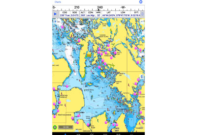
Navionics is primarily a chart maker, and they have great charts, but their charts and free government charts are the only ones available to users of their app. iNavX does not produce charts, it is an app developer focused on providing a functional platform for recreational boaters and hardened mariners. That includes access to multiple chart developers so boaters can choose the best charts for their area. With iNavX you can download charts from:
- Fugawi
- Blue Latitude Press
- CHS
- Explorer Chartbooks
- Navionics
- NV.Digital
- Solteknik HB
- TrakMaps
- THEYR
- Waterway Guide
Access to this wide range of charts for iNavX is driven by Fugawi and clearly sets the app apart, even with the cost of purchasing specific charts.
Interesting to note is that Navionics provides vector charts while iNavX uses quilted rastor charts. The vector charts are more interactive, offer additional layers that can be placed over the map and require less storage space in your device. The quilted rastor charts present the same view and information found on paper charts, which can make it easier when going between paper charts and the app.
Both apps feature views that allow zooming in/out, making waypoints, showing standard real-time instruments, track record and real-time weather overlaid onto the map.
Navionics does utilize SONARCHART but it is not possible to hide created waypoints and there is no option to return to a former point or put a second waypoint in the same location. Even with Navionics+ included in the initial download if you want the ‘Nav Module’ for advanced route planning, ‘Advanced Map Options’ or ‘Autorouting’ they need to be individually purchased in the app.
Included with purchase of iNavX are advanced route editing, overlaid forecasted weather, Marina and Navaid search and AIS tracking with the integration of an AIS receiver or transponder.
When you consider the associated costs and features iNavX delivers a broader and more useful platform, but requires taking the time to purchase the charts for your area. Navionics requires purchasing features that come with iNavX, but does include the Navionics charts for the geographically directed app you purchased.
iNavX is a superb product at only $27.99 and is not limited to using charts by a single provider but allows purchasing of the best charts, weather and data from numerous providers.
In the next instalment how to protect your iPad from the elements while also keeping it charged during long hours of navigating will be considered.
Comments or questions? Email OwenHurst@Kerrwil.com
As a side note every mariner should carry and be prepared to use paper charts in the event of electronic failure.
About the author:

Owen was born and raised in Midland, Ontario on the shores of Georgian Bay. He has been boating and navigating ever since and has experience as a paddling instructor, rescue boat operator, and a passenger vessel operator for Parks Canada. He obtained his Master’s degree from McMaster University and holds SVOP and MedA3 certificates from Transport Canada.
