Furuno’s TZT13X Does It All
Mar 27, 2025
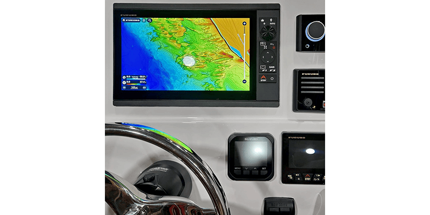
Furuno’s NavNet TZtouchXL TZT13X Hybrid Control Multi-Function Display (MFD) is designed to deliver advanced Navigation, Fish Finder, Radar, and system integration capabilities in a compact form factor.
The TZT13X combines a responsive multi touch display with a built-in RotoKey™ and dedicated button controls, offering operators flexibility in how they operate the system. This hybrid interface is particularly useful in varying sea conditions, allowing precise control whether underway or at rest.
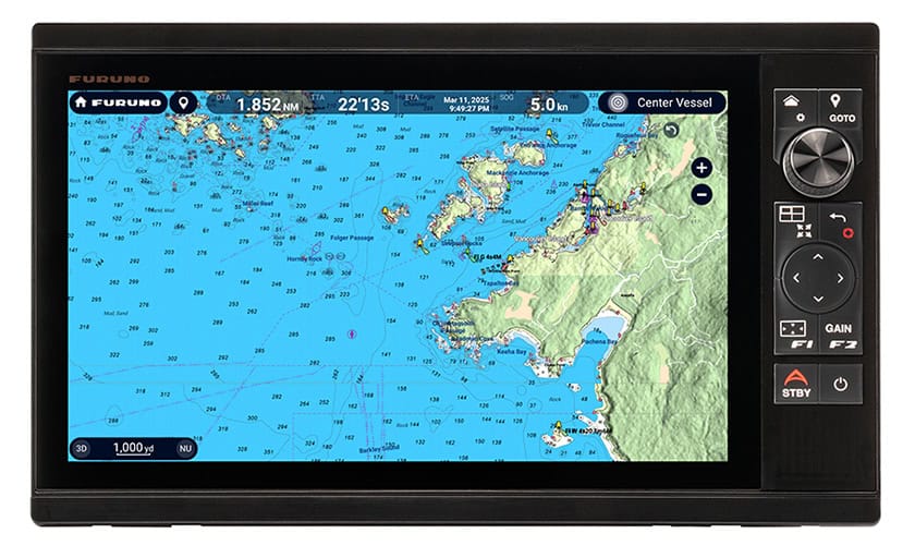
The TZT13X supports Furuno’s next-generation TZ MAPS, a powerful charting platform that merges vector and raster charts with satellite photography, high-resolution bathymetry, and community-sourced data. TZ MAPS offers enhanced visibility of navigation marks, fishing spots, and seabed contours, as well as intelligent AI Routing that plans routes in seconds, taking into consideration the boat’s draft as well as charted depths and navigational obstacles. These advanced mapping tools allow mariners to customize their charts to meet specific navigation or fishing requirements.
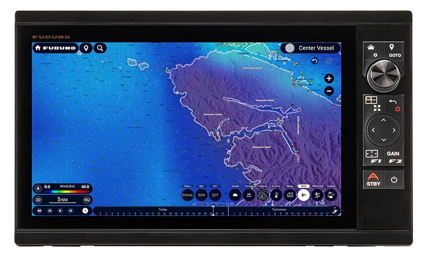
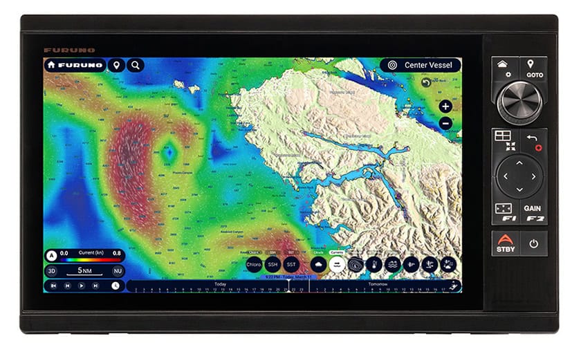
The TZT13x also includes two brand-new features, Dynamic Mooring and TZ Weather. TZ Weather is a free service that delivers enhanced situational awareness and forecasting for mariners worldwide. Global and regional weather predictions from NOAA’s Global Forecast System (GFS) are delivered to your MFD for any area and date range you desire. A premium subscription service is also available for $8.99 US per month that provides higher-resolution data from a number of global models including ICON, NAM CONUS, Arpège, and AROME. You can even configure your MFD to download the latest weather immediately on startup. Additional tools such as Meteograms and customizable presets help you pinpoint the best departure times and assess evolving weather patterns at specific locations.
Dynamic Mooring integrates real-time weather forecasts with TZ MAPS’ advanced mapping technology. With just a date selection and the current weather forecast downloaded, the TZT13X automatically analyzes the coming wind conditions and topography to provide a clear, color-coded mooring status: green for protected, orange for partially protected, and red for exposed. These mooring locations are extracted from high-resolution vector maps and enhanced by contributions from the TIMEZERO “Community Maps” network, ensuring an up-to-date and comprehensive anchorage database and helping you make informed mooring decisions.
Full-featured Fish Finder capabilities are built into the system, supporting a variety of fishing solutions, including TruEcho CHIRP™, traditional CW, optional deep water Multibeam Sonar, and built-in multi-frequency CHIRP Side-Scan. The TZT13X is compatible with Furuno’s ACCU-FISH™ and Bottom Discrimination features, delivering valuable information on fish size and bottom composition. Additional functions such as Fish-It/Drift-It help mariners mark productive fishing locations and plan optimal drift routes for precise targeting.
The TZT13X connects seamlessly with Furuno’s extensive lineup of traditional X-Class or NXT Solid-State Doppler Radar sensors. When paired with a Furuno Radar, the TZT13X offers enhanced safety tools like Risk Visualizer™ and AI Avoidance Route™. The Radar overlay function further supports intuitive operation by displaying Radar targets directly on the chart screen.
With its hybrid controls, scalable architecture, and broad compatibility with a wide range of sensors, the TZT13X enhances the functionality of any helm.