Software manufacturer Northport Systems Inc. has announced that its popular Fugawi X-Traverse online service now supports over twenty million square miles of coastal, river and lake coverage, making X-Traverse the largest online provider of navigational content in the world. X-Traverse offers more than 160 product options including 45 fishing charts, 105 navigation charts, and several weather services from brands such as the award-winning Navionics cartography, Canadian Hydrographic Service, nv charts, TRAK MAPS, Swedish Hydrographica, New Zealand’s nzMariner, Hilton Realtime-Navigator fishing maps, Theyr Weather and more.
“Northport Systems is pleased to offer our subscribers access to the largest online repository of downloadable charts for Europe, Asia, Oceania, Caribbean, and North and South America,” said Robin Martel, President of Northport Systems. “X-Traverse’s success story is proof that our customers want choice and convenience on demand. By adding more content, new software partners, and maintaining great prices, navigation has never been more accessible.”
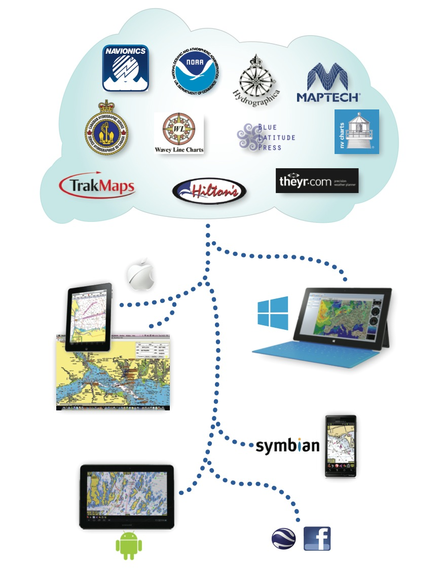
Using Fugawi X-Traverse, customers can install and view raster or vector charts on their choice of software such as MacENC, GPSNavX, iNavX, PathAway, Fugawi Global Navigator, Fugawi Marine 5, and other client software. Once downloaded, charts, maps, and other X-Traverse content can be viewed without an Internet connection on compatible software for viewing, planning, or navigation purposes. Members benefit from X-Traverse’s ability to store and exchange waypoints, routes, and tracks between different software and services such as Apple devices, Windows PC, Facebook, and Google Earth. As X-Traverse regularly updates content, members are emailed instructions to download new chart content free of charge.
An annual Fugawi X-Traverse Passport is available for $10.00, chart prices will vary according to the chart provider and region. For more information on Fugawi X-Traverse contact sales@x-traverse.com or visit www.x-traverse.com

