Dinghy Cruising with Rob Dunbar on the Eastern Shore
Feb 22, 2018
“Let me go, Pappa! Let me go!” That was my battle cry as a three-year-old when my grandfather lashed a line to his dinghy and set me adrift in the Strait of Canso. The Strait of Canso separates mainland of Nova Scotia from picturesque Cape Breton Island and I can remember the day very clearly. It was overcast with a cool northerly breeze giving the water a grayish appearance.
 My grandfather played with me on the pebbly beach below his house. We threw countless rocks and watched the ships pass by headed for far away lands that I had only heard about. I remember telling him that someday, when I grew up, I wanted to work on the big ships and see the world. Hearing that, he decided that I was big enough to take command of my first vessel. Thus, he launched the dinghy used to row out to his larger boat at the mooring. He tied a long line to the bow of the small wooden dinghy and sent me on my first solo voyage.
 He thought it funny that I wanted him to throw his end of the line into the water and be free of the land. I wanted to drift farther out into the strait. I vividly remember yelling at him “Let me go, Pappa! Let me go!” We had a lot of fun that day, a day that I will never forget. He made me promise not to tell my parents of our exploits and he took that secret to his grave. Sadly enough, I lost my paternal grandfather when I was 15 and living six provinces away in Calgary. I miss him greatly but am glad to have his memory. …
 Day One: Saturday, September 2nd.
Thirty-six years later, I could be heard uttering these words: “Halifax Coast Guard, Halifax Coast Guard, Halifax Coast Guard, this is sailing dinghy Celtic Kiss on Channel 16.”
“Did you say sailing dinghy?” asked the radio operator.
“That is affirmative, this is sailing dinghy Celtic Kiss and I would like to file a float plan.”
“OK, Celtic Kiss, go ahead.”
“I am departing Halifax Harbour at 1015 local time enroute for the Strait of Canso.”
 I then provided the particulars of my CL16 sailing dinghy’s safety and navigation equipment, which consisted of an air horn, Class “B” flares, floater jacket, a paddle, 2HP engine, compass, handheld VHF radio, handheld GPS, 8 charts, two plotters, safety harness and a cell phone. From studying my charts, I placed myself one mile south of Devil’s Island and headed on a compass reading of 090 for a week of dinghy cruising along Nova Scotia’s rugged Eastern Shore. This September morn was greeted with much anticipation and satisfaction. Concocted six years earlier in Calgary, it was a personal dream of mine to sail an open boat along Nova Scotia’s scenic coastline. The dream was finally becoming a reality.
 In the weeks of getting the boat ready to tackle Canada’s Ocean Playground, I was quizzed by many about the integrity of Celtic Kiss, and I am sure that some curious folk questioned my sanity. However, the pre-trip planning was literally years in the making, albeit from a computer in my former home of Calgary. Sailing on the internet made my job very easy despite the many hours spent downloading 500 waypoints into my handheld GSP unit. And to my great relief, all the waypoints I had marked for the Eastern Shore matched up to my charts. So obviously I knew where I was going. The next challenge to conquer was loading the boat with non-perishable food, as refrigeration is simply not an option for an open dinghy. This was an easy fix with an abundance of canned food, bottled meat, bottled water, and plenty of applies, oranges, fruit juices, UHT milk, a few boxes of Nutri-bars, and a small container of almonds. And if for some reason, I ran out of food, a fishing line in case I had to rely on the sea’s bountiful run of mackerel.
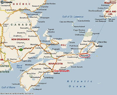
 Sleeping … not a problem as I had two options: The first was to sleep under a boom tent on the boat, and the second was a small tent on shore. Because of my painstaking hours of pre-trip planning, I can honestly say that I finally slipped my lines from the Shearwater Yacht Club in Dartmouth without a sense of nervousness. For rather than looking at this voyage as single 152-mile trip in an open sailing dinghy, I thought of it as a series of day trips over a weeklong excursion. After all, that is exactly what it was. How long would the day trips be? According to my GPS, the “average” moving speed during most of my other day sails normally reads 3.3 to 3.5 knots. That doesn’t sound too impressive considering most times I look at the actual moving speed, the reading is anywhere from 4.5 to 5.2 knots. So, with those results, I planned to make an average daily passage of 20 miles and anything over that would be a bonus. And though the “route” (see map) from Dartmouth, just outside of Halifax, to Pirates Harbour near Mulgrave on the Canso Strait reads 152 miles on the GPS, I also added an extra 50 miles to allow for headwinds, landing on islands, or finding safe harbours not included as an actual waypoint. Now this mileage adds up to 202 miles at 20 miles per day which in a worst-case scenario should take no more than 10 sailing days to my destination. To this I also added two non-sailing days to allow for inclement weather and for boat repairs. Thus, in a nutshell, my unofficial float plan was for a 202-nautical-mile trip at 20 nautical miles per day over a 12-day period. Each day was planned for 8-10 hours of sailing time.
 On the first day out, my OTP (on time performance) was already in jeopardy. I awoke at 0530 and made my way to down to Shearwater Yacht Club to catch the ebb of the high tide at 0730. Despite my careful planning, everything seemed to be quickly unraveling, it was taking much longer than anticipated to load and re-arrange my final stores and launch the boat. I didn’t depart until 1015 and now the NE wind was coming to life. However, this later than expected departure allowed a small group of well-wishers consisting of my mother, who was visiting from Calgary, and uncles, Harry and Charlie, both of Dartmouth to see me off.
As I was again sailing solo aboard Celtic Kiss and given the forecast and current sea state at the harbour mouth, I thought I’d be better off sailing under a reefed main so as not to be overpowered. I soon learned that this was an unnecessary exercise as the added ballast of supplies made Celtic Kiss more stable than I had anticipated. What a pleasant surprise to find my 350 lb. dinghy behaving like a keelboat. Time to shake out the reef and get on a close reach. If the wind held there was an outside chance that I could make my first landfall, near Egg Island, as planned. It seemed to take forever, but Halifax finally disappeared from sight.
During the first day, I find myself carefully studying my chart, looking up frequently to pick out my landmarks and taking fixes. Devil’s Island at the mouth of Halifax Harbour has finally disappeared. Cow Bay comes and goes, as does Lawrencetown. Shut-in Island then appears before my bow and just may end up being my first landfall. Not a great start, but at least it is a start, though I would like to end up where I told the Coast Guard I would be. I had originally planned to make my stopovers no later than 1700 hours to allow myself time to cook a meal and set up my tent before I lost my light. At 1545, I find myself abeam of Shut-in Island. Should I stay or move on?
 After much contemplation, I decide to make up for lost time. Given the reduced wind, I settle on making landfall 4 miles ahead of my current position, rather than the 8 miles to Egg Island or nearby Long Island. To compensate for a dusk landing in Jeddore, I decide to eat supper while sailing. Out comes a collection of apples, oranges, and a cold can of chunky soup … washed down with a Pepsi. Not a stellar meal but it does the job
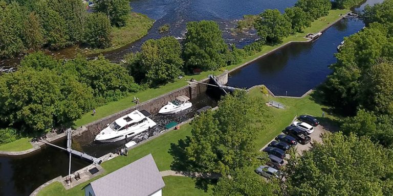
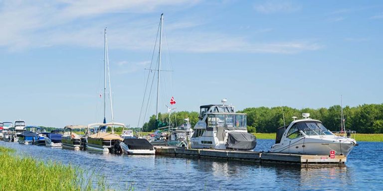
On approaching the dock at Baker’s Point in Jeddore Harbour, I attempt to call the coast guard on my cell phone to let them know where I am. To my great surprise, the screen on my cell phone flashes a depressing message: “searching for service”. Being a bit frustrated at this, I can only hope to contact the Coast Guard on someone’s landline before they start searching for me. At 1933, I tie up alongside the fishing boat Grandfather’s Gift and give the cell phone one final chance. To my great surprise and relief, I manage to contact with the Coast Guard and let them know I am secured at Baker’s Point. After tidying up Celtic Kiss and preparing the cockpit for my first night’s sleep aboard my luxury dinghy, I hunt up an Alexander Keith’s as a nightcap to celebrate a successful passage of 29.3 nautical miles.
 Day two:
The next morning, I awaken at sunrise eager to get underway. My plan is to do a quick study of the charts, listen for the weather and re-open my float plan. After a quiet departure from Grandfather’s Gift, I take advantage of a following wind which prompts me to fly the spinnaker. This glides me past my previous night’s unreached destination of Egg Island and onward to my next destination of Pope’s Head on Phoenix Island.
It was during this leg of the trip that I encountered an interesting phenomenon. Even though the wind was light, the rocks near Egg Island emitted a whistling sound as if wind was blowing though a ship’s rigging. As I sailed by this area, I was able to study the rocks, thinking I might be able to locate a herd of seals or some other inhabitants, but nothing was spied through the binoculars. If I were the superstitious type, I might have surmised that the wailing I heard was my seagoing ancestors watching over me.  I am quite pleased with my spinnaker handling skills. It took me quite awhile during sea trials to learn to do this by myself. The forecast calls for increasing winds of 15-20 knots. I don’t want to be overpowered, so my eyes regularly scan the sea for dark water signifying heavier air. At approximately 1000, the forecast wind hits me like an invisible wall and I feel it prudent to quickly douse the chute and stow it back under the forepeak. Soon the wind pipes up to 20+ knots, and I find Celtic Kiss surfing down waves at 6.5 knots under a full main and furled jib. As the afternoon wears on, the wind increases even more, prompting me to reef the main as I continue my course towards Pope’s Head, which I estimate to be 2-3 miles away.
 All was going well until a sudden a gust hit me, and Celtic Kiss rounded up into the wind. I quickly recovered and hove to while I took a fix on the chart. I decided it would be wise to take refuge in the lee of the land. Somewhat disappointed that I would once again fail to make my intended landfall, I took solace in knowing that I was close to my intended destination and confident I had made the correct decision to seek refuge.
 By the lay of the land, I knew I was going into a well protected area. This was quite important as the forecast called for gale force winds and occasional rain for the next day. My new course took me into Tangier Harbour and eventually to the sandy shores of Baltee Island. Immediately, I was impressed with the white sandy beach in a well protected cove where I was quite content to stay and wait out the oncoming gale. While soaking in the scenery, I distinctly recall saying out loud to nobody in particular, “Who needs Cancun?” Once I had secured myself on this sandy beach and having attained some local knowledge from a family who were enjoying a Labour Day picnic, I immediately called the Coast Guard on my cell phone and closed out my float plan. The fact that I had communication with the outside world was a pleasant surprise.
 Day three:
The Baltee Island stopover gave me time to evaluate my journey. According to the GPS, 52 NM had passed under the centerboard with no problems whatsoever. At the outset of the trip, I had concluded that the added food, clothing and camping gear would add ballast and thus stability. I was in fact pleasantly surprised to note that all the extra weight was making Celtic Kiss behave more like a keelboat than an open sailing dinghy. A relaxing day on this pristine little island also provided me an opportunity to re-organize my gear. During the past two days of sailing I had noted that the items I needed on a regular basis had to be more accessible. I was frequently in need of spare batteries for the GPS, charts, flashlight and a steady supply of fruit/snacks. As well, I was able to get the barbecue out and enjoy my first cooked meal. To celebrate my successful trip, I treated to myself to some bottled chicken and baked potato with all the trimmings. In short, it was a magnificent meal, and I found myself truly content on the shores of Baltee Island. That night, I went to sleep serenaded by the Tangier Harbour Fairway Buoy rhythmically whistling in the waves, guiding mariners to safe refuge.
To be continued ….