Oar and Sail to Desolation
By Tim Ellis
A small-boat passage from Horseshoe Bay to Maurelle Island, north of Desolation Sound, is an adventure in brisk sailing and peaceful rowing.
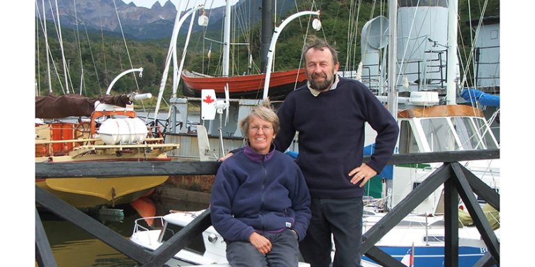
As a rower and dinghy sailor, I was pleased to discover a slim volume entitled Oar & Sail – An Odyssey of the West Coast by Dr. Kenneth Macrae Leighton. Leighton rowed and sailed his 14’ boat, sporting an unstayed standing lugs’l rig and a pair of nine-foot wooden oars, from Vancouver to Prince Rupert over two summer holidays. The first stage took him to Sonora Island, just north of Maurelle Island where we camp. Later, he launched at Port Hardy and completed the journey.
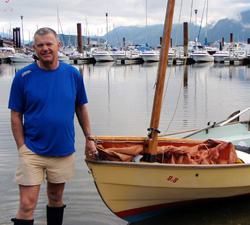
His book inspired me to follow in his wake. There was not much planning required – Leighton had already done it – and my Drascombe Scaffie BoB was ready for the voyage. BoB is 14’ 9” long, engineless, with an unstayed lugs’l rig and a pair of 9’ 6” oars. She has wet her keels in the Okanagan Lakes, the Fraser River, the estuaries, bays and inlets around Vancouver, and as far north as Desolation Sound. She is simply ideal for cruising. Her standing lugs’l points surprisingly well and her time up the Strait of Georgia speaks for itself: 4.5 Knots sustained for more than four-and-a-half hours in 10-12 knots of breeze. We carry an eight-lb Danforth anchor, VHF, compass, safety equipment, cooking and sleeping gear, food that doesn’t require refrigeration, and a half-bottle of Balvenie single malt in a plastic bottle.
At 0630 on June 15, 2011, we trailed “BoB” to Horseshoe Bay in West Vancouver, rigged her and launched, and at 0825 I set off, rowing and sailing in a breath of wind from the west-northwest. The wind increased steadily during the day and I put into Gibsons to escape it just before 1500, then departed again at 1615 for the passage along the coast to Roberts Creek.
It was sailing of the wet and wonderful kind, hard on the wind and tacking the whole way, but as 1800 approached the wind died well short of Roberts Creek. I rowed the last five miles or so and was welcomed at the creek by two Coast Guard Auxiliary officers from Gibsons, who had seen me leave the harbour. They followed my progress from the coast road and, waxing lyrical about BoB, guided me to the safest possible place to tie up. As I surveyed our mooring, a small crested bird landed on my head. We froze for a second or two until, panic-stricken, it shot off into the twilight.
The next morning, 0530 found us at sea in light, variable winds and a nasty short chop that made it a constant battle to keep BoB moving. Eventually, the sun won out over the haze, the wind and waves dropped, and we made steady progress two to three miles from the mainland shore. But by mid-afternoon the wind blew southeast and hard. Before long I had two reefs in the lugs’l and swished northward at an astonishing speed. Seeking relief, I drove into Quarry Bay at the entrance to Jervis Inlet but found no beaches or decent anchorages. I popped back outside and turned once more to the northwest past Cape Cockburn, then into Blind Bay before finding a safe berth in Musket Island Provincial Park. It was occupied by several large yachts, mostly American-flagged, and one, now two lonely Canadians. I was astonished when they told me they quit the strait much earlier because it was so rough.
I had to manhandle BoB into the water the next morning because I had misjudged high tide, which passed a half-hour earlier. I made my way northwest toward the tip of Texada Island and Grief Point – the halfway point of my journey and the boundary between the protected waters of the Sunshine Coast and the northern Strait of Georgia, between Texada and Quadra islands.
This great bight has a long history of storms and loss. The wind blew a steady 15-17 knots from the southeast, the sun shone, and I had a choice: I could go inside Harwood Island and stop at Lund for a night’s rest, then continue the following day to Maurelle, or enter the bight and save a day. I hesitated, measuring my stamina against a long day’s sail, the possibility of difficult weather and likely refuges. Then I chose the bight.
At 1140 I transited Algerine Passage and steered for the southern tip of Marina Reef, arriving at 1615. Here, the winds were more stable at 10-12 knots with occasional gusts, still southeast. Landmarks came and went effortlessly, but not once did I take my eyes from the sea ahead, nor a hand from the tiller. I made Hoskyn Channel with the dying wind. During the entire passage I did not see a single sailing yacht, and perhaps two or three skiffs checking on crab pots in the distance. Where was everyone?
I rowed the last 10 miles or so to our camp, oblivious to everything except the poetry of motion and pause, stroke and feather. It was perfectly still and beautiful. At 2100 I was moored at the camp and admiring the Columbia III, now a mother ship for kayakers but for many years one of the Columbia Coast Mission boats. I thanked Leighton for his inspiration and toasted his memory with a large whisky before retiring to dream in the gently but persistently rocking arms of Morpheus.
The trip had taken me 61 hours from departure to arrival, 42 hours at sea. I spent about 15 hours at sea rowing, and the rest under sail. My average speed for the trip was about 2.8 knots.
Tim Ellis is a marine surveyor based in Burnaby BC.
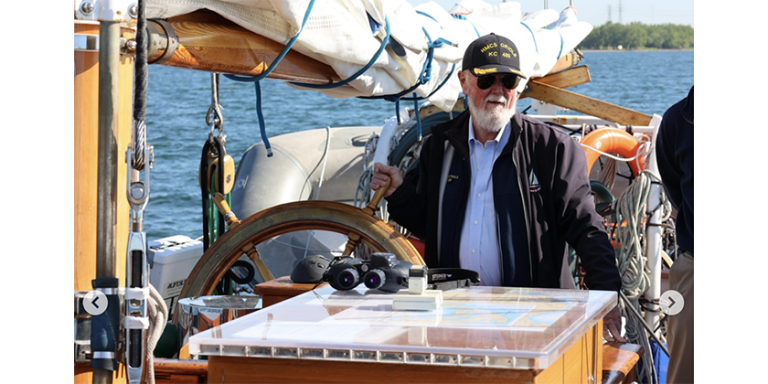
Photo Caption: Tim Ellis and BoB ready for departure at Horseshoe Bay.