Get Lost
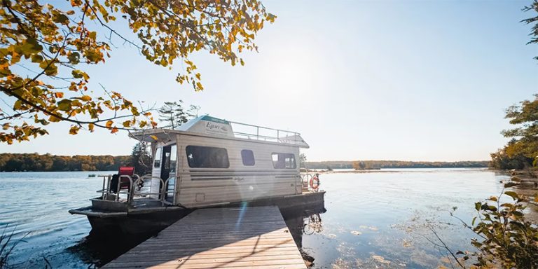
 Most of us usually go boating on waters with which we are familiar, leaving the wharf of mooring where the boat is usually kept and heading off for the day, maybe even an overnighter. Sometimes we may plan a trip that takes us away from our home waters and venture into the unknown – the other side of the bay, up the coast or down the river to another lake. When we do, prudence means we have the right tools for navigation – at minimum: a compass and charts, perhaps a depth sounder, a GPS unit, maybe even a radar unit, probably not a sextant but hopefully a log book. It is with these tools and proper practices that prevent you from getting lost. But it does happen to some boaters and can result in nothing more than a minor delay or it could end up being a dangerous interlude with shoals, other boats or wide open waters in inclement weather. And yes, weather or darkness (i.e., restricted visibility) usually play a role, however, some of us can even mess up on a perfectly sunny and calm day.
A couple of years ago, my father-in-law and I were placing a mooring at a new isolated anchorage where we were going to keep the sailboat. The seclusion was a result of isthmuses and peninsulas and islands that saw some convoluted passages, tidal currents and tricky sand bars and shoals. We had charts on board and I had taken a gander at them prior to our little expedition noting shallows, landmarks and actual buoys placed by the Coast Guard. We were never going to be far from land and should only take an hour to get there and it was indeed a pleasant sunny, warm and calm day.
We were under power, putting along rounding a point into a tight and twisting channel when a couple of lateral buoys came in sight – a red and green apparently side by side, perhaps offset a bit. My father-in-law alluded to the fact that these were silly marks to have in place since it was categorically clear that we would simply continue on our course and pass between them. The Coast Guard must have felt boaters around here were really inept!
Historically, son-in-laws seem to have an automatic deference to their father-in-laws and even more so when on their father-in-law’s boat, so when my memorized course notes told me it wasn’t that simple I only quietly suggested that it might not look as it appears and we should refer to the chart – to which he politely scoffed. So, I did what I shouldn’t have and kept my mouth shut and continued on course. Luckily we were only making 3-4 knots when the keel slid into a soft muddy bottom – just as we approached the two marks lined up pretty much between them. How could this be? Well, typical of lateral marks, you better know which way you are going relative to the channel; in this case we thought we were going when actually we were coming. When you looked at the buoys in the reverse it was clear that, categorically, these marks were set up so that we would zig below one and then zag up to go around the other, navigating around two muddy spits projecting from opposite sides of the channel.
With my father-in-law hanging off the pulpit to trim the bow down, I put a little reverse thrust to the engine and we wiggled out of the mud, carried onto our new anchorage to place the mooring and thereafter became localized in that we knew when we were coming and not going and charts were always close at hand.
Restricted visibility is a darn good excuse for losing your bearings but getting lost is usually a result of not keeping track of them in the first place. Trusting your instruments in nasty weather or simple darkness is vitally important and keeping a log will ensure you don’t confuse how long you have been on one course or at one speed and when you made that course adjustment.
Years ago when I was working the Coast Guard Inshore Rescue Boat on the south shore of Nova Scotia we woke at our base to a typical pea soup morning – t’ick, t’ick fog. Calm, warm and very damp with almost no visibility that meant for a quiet day – at least until the sun had a chance to burn off the fog. Then we heard a squawk over the VHF, a vessel conversing with Halifax Coast Guard Radio – he had been solo-sailing his 40-footer all night coming down the coast in the dark and the fog and now very fatigued, figured he had absolutely no idea where he was. However, if we could hear him he had to be in our area, somewhere out there. As the conversation continued, we learned that that he was smartly stopped, could hear a bell, breakers and a fog horn but just couldn’t put two and two together, but we were on the case. We knew our area like the back of our hands and pulling out the charts and using the strength of his VHF signal, we started to angle in on him. We contacted Halifax CG Radio and requested to talk to him directly so that we could ask more questions to narrow down the search. It wasn’t long before we were able to tell him where we thought he was and the answer was unfortunately not reassuring to him – he was inside Cross Island and approaching Hell’s Rackets! With the sound of that, he decided to stay where he was while we charged off into the soup. Local knowledge and logging our course and speed allowed us to find him, although it took a good hour to get there. From there we acted as an escort bringing him past shoals, between islands and into a safe haven for him to get sleep and a good start later in the day.
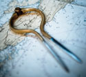
Today, the tools are very different and it really is hard to get lost. Fundamentally, a compass, charts, a log book and proper procedures and skills should keep you off the rocks. A chart, paper or now, more often, electronic ones, offer so much information to help you to determine where you really are – buoys, light sequences, towers, land forms, distances, bells, fog horns –the list goes on. They are as indispensable as is a good ol’ compass – one that doesn’t need batteries or power is fundamental to navigation. A GPS is an amazing tool that can tell you where you are, but without a nautical chart, you will not be aware of navigation hazards, compass variation or really how to get from where you are to where you want to be. As the saying goes in the SAR business, if the vessel in need of assistance has a GPS, it will take the search out of Search and Rescue mission. RADAR units for small vessels are effective and inexpensive and are a great aid in restricted visibility. Knowing how to use your navigational aids is important as well – lateral buoys (red and green) are great when used in an obvious channel, cardinal buoys even better. Range markers, RACONS, lights on fixed and floating structures.
There is a lot out there that should help but planning is the most important step in a day on the water – have the right tools, training, ensure the vessel is in top condition, check the weather and plot your course and tell others your plans (file a sail plan). In the event you do need help, other boaters and the Coast Guard are ready to help you; but do the right thing, don’t support Search and Rescue – don’t get lost!