Sailing the Fjords of Norway
Aboard Distant Shores II
Norway and its fjords have always held an appeal for Paul and me not just for the extreme natural beauty but because Norway’s fjords helped shape one of the greatest group of seafarers in history, the Vikings, whose history fascinates us. The opportunity to take our own boat to Norway and sail in the fjords on the west coast after visiting Scotland last summer was irresistible. We had to go.
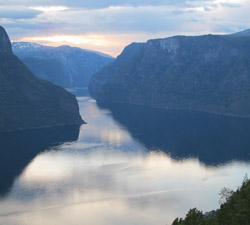
Fjords are basically long narrow inlets from the sea. They make land travel difficult since they deeply penetrate the coast making them hard to get around; in Norway most fjords have enormously tall cliff sides, often many hundred of metres high, so they are hard to cross. This forced the coastal people of Norway, a harsh mountainous land, to take to the sea as a way to travel and trade and also to harvest its bounty. He who ruled the coastal sea route – the Northern Way or “Norway” – ruled the land. We wanted to see it for ourselves.
 The sailing season in Norway is pretty short, just 6-8 weeks in June and July, so we had been pushing hard to get there from England via Ireland and Scotland to do some exploring and then get south again before the season closed in.
Our first hurdle was crossing the North Sea from Scotland. The North Sea is notorious for bad weather and since it’s shallow can kick up nasty seas to boot. But if we waited too long for good conditions to cross we’d be cutting short our time there. The North Sea is also festooned with oil platforms so looking at the chart it appeared that planning our route to cross it would be a slalom course around the rigs. However, we were game and somewhat curious too – new navigational challenges!
We had sailed to the far north of Scotland to the Shetland Islands (more on the Shetland and Orkney Isles on the return voyage next issue) where in late June we jumped off from the Muckle Flugga light at 60º 51’N 0º53’W, the most northern point of the United Kingdom, to sail overnight 195nm to the Marstein light at 60º 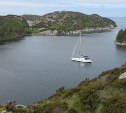 8’N 5º 4.5’E on the west coast of Norway. The Marstein light marks the entrance to the fjord leading into the major port of Bergen.
My fears about the North Sea quickly subsided as we experienced one of the best night passages ever. First, at this latitude it never gets dark at this time of year! Getting up for my 0200 – 0600 watch was a breeze with daylight. Even on Paul’s watch at midnight, he had twilight and could easily see all the North Sea oil rigs we were passing en route over Halibut Bank, Bressay East Ground, and Viking Bank. They are brilliantly lit and can be seen from miles away.
And there are so many of them it was like connecting the dots. There was nearly always an offshore platform in sight and we sailed from one to the next; it was like a little oasis of civilization strung across the sea. There is a 500 m security zone around oil platforms that you must sail outside of and there are guard ships around each that politely hailed us as we went by. There were guard ships, supply ships and helicopters coming and going. I’ve never had so much company and 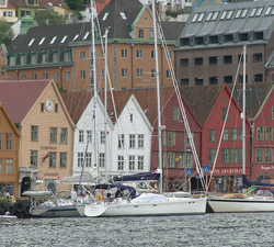 conversation during what are often lonely times on watch at sea!
During the entire crossing we were never off soundings. This is most unusual when on an offshore passage. We also crossed Meridian 0º of Greenwich on this passage. Cool!
The voyage from Shetland started off with light southwest winds but then went northwest and strengthened to 20-25 knots. We had a good night but unfortunately, as we approached the coast, a constant drizzling rain developed but, flying our small self-tacking jib and a reefed mainsail, we soared between the raindrops towards Norway!
Once we reached the Marstein light at the entrance to Korsfjord, we had another 25 nm to go within the very protected and stunningly beautiful network of channels and fjords (Raunefjord and Byfjord) to reach the historic port of Vågan in Bergen, once an important base of the Hanseatic League. Strangely, for us, when we came in off the sea and entered the fjord we suddenly went off soundings! Not usual when reaching land but as a general 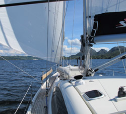 rule, fjords are as deep as they are tall.
Arriving in Bergen by sea whether on your own boat or on a cruise ship or ferry is magical. The old waterfront warehouses where Norwegian stockfish was once processed and shipped to ports all around Europe by the Hanseatic merchants based here, have been renovated into colourful boutiques and restaurants and the deeply rafted guest quay is right in front of them. We quickly found a spot and realized we were in a raft with Milvina owned by Canadian friends from Montreal who we hadn’t seen for a couple of years. How nice to have someone to celebrate Canada Day with. July 1st was the next day. We spent a very pleasant afternoon with Neil, Helen and their son, Michael, celebrating our national day; we lucked out with sunshine too. Bergen, the second largest city in Norway, is the wettest place in Norway with rain on average 260 days a year.
Whenever Paul and I complete a passage and arrive in a new country we always treat ourselves to dinner out. But eating  out in Norway is very expensive so rather than something fancy, we shared a salad, medium pizza and a couple of beers – the total was 400 Norwegian Kronar (NOK) or about $75 US dollars! An order of fish and chips in a cardboard box with two coffees in paper cups would have been about $40! The exchange makes prices over-the-top for non-Norwegians like us. Better to buy good quality Norwegian food in grocery stores and cook onboard. Luckily we had been warned beforehand and had stocked up on lots of supplies in the UK before leaving which helped make cruising in Norway more affordable.
Dockage, however, at the town quay was within reason at 150 NOK per night which is about $0.50 per foot/per night. This did not include power. You pay by credit card at an Automat machine at the head of the harbour. The instructions are in English as well as other major languages.
Norway is not a member of the EU so as a foreign yacht we had to clear in with both Customs and Immigration. (We cleared out of the EU in Lerwick in Shetland and carried clearance papers but were not asked for them in Norway.) The 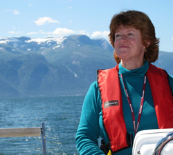 Customs office in Bergen is right in the harbour across from the visitors quay so walking over with our ship’s papers was easy. To get our passports stamped for Immigration we were told to go to the Police Station a couple of blocks up from the Tourist Office at the end of the harbour. It took a little while to find the right person to deal with us there but everyone was very kind and helpful and eventually our passports were stamped and the job was done.
Now we were free to explore this lovely town with its warren of old alleyways, historic buildings, bustling fish market and beautiful views from the top of Mount Fløyen. We rode the Fløibanen funicular railway to the top to film the panorama. We also really enjoyed a tour through the Hanseatic Museum located in an 18th century merchant’s house on the waterfront where we learned about the life and work of the Hanseatic League in Bergen.
The city of Bergen was to become our central base for cruising the west coast of this dramatically beautiful country. South of Bergen were several island groups we wanted to explore and north of Bergen, the fjords, especially Sognefjord, one of 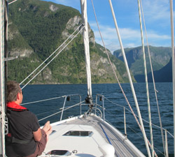 the world’s longest fjords.
We decided it was best to go south first, then conclude our cruise of Norway in the north since departing from northern ports would give us the best angle on the prevailing northwest winds to sail back across the North Sea to the Shetland and Orkney islands north of Scotland.
One of the challenges of cruising in Norway is figuring out where to go – there are literally thousands of choices! With the numerous barrier islands plus fjords off fjords off fjords, route planning can be a challenge. We did our research by first surfing the Internet to find websites and blogs of other cruising sailors who have experience cruising here. This way we got a feel for common routes and “favourites” plus recommendations on cruising guides and other resources.
We found the most helpful cruising guides for our style of cruising was the Imray pilot entitled “Norway” by RCC Cruising Club Pilotage Foundation/Judy Lomax now in a second edition and an wonderful e-book cruising guide which we  purchased online at www.norwegiancruisingguide.com and downloaded onto our iPad.
The best and most fun way to research is to talk face to face with sailors you meet along the way and to go over the charts together marking good places and getting their opinions on decisions you’ve made merely through reading.
Paul carries an iPhone onto which he’s downloaded the Navionics app which gives us electronic charts in a portable style. Then when we meet someone and they start talking about great places he can quickly bring up the chart of the area and mark a waypoint or suggested route. Wow! It’s great and very inexpensive. It’s great for planning. We use our chartplotter for navigation but the mobile apps are good back-ups.
So with our route planned south to Haugesund, we cast off from the town quay in Bergen. Winds were light so for most of the morning we were motor-sailing but we were thankful for the quiet warmth and stunning surroundings where the  snow-topped mountains glimmered in the rare sunshine.
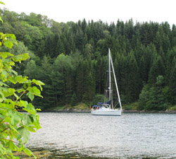
For about three hours we wound our way out through the fjords (Byfjord, then Raunefjord to Korsfjord) back towards the North Sea and just before the Marstein light where we’d made landfall in Norway a few days before, we tucked into the tight but very protected wilderness anchorage on West Horgo. The anchorage here is very deep, 21 m (69 ft.), but we carry 80 m (262 ft.) of 3/8 chain and the forecast was for very light winds for the weekend, so we put out over 60 m (197 ft.) which is 3 to 1 scope and were quite comfortable.
The next day, we raised anchor, leaving Horgo and had a fabulous downwind sail to the port of Haugesund. Our route took us down Stokksund, the lovely channel or sound between the islands of Stord and Bømlø. We poled out the genoa and flew wing and wing downwind, down-channel and down-current. Although the day was cool and overcast, the universe came together for a lovely day of sailing.
Cruising on the west coast of Norway you often have good winds but flat seas due to the numerous surrounding islands. 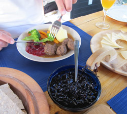 You just have to be prepared for strong unexpected gusts if the surrounding cliffs are high.
Once through Stokksund and under the bridge, we entered Bømlafjord and then headed out into a stretch of open water called Sletta, which is classed as a dangerous sea area due to the lack of shelter, great variations in depths (2-250 m) which can cause dangerous turbulence and strange currents. However, we had light wind with a tide so it was no issue. We just enjoyed the scenery as we sailed gently along the coast.
July is high season and we were prepared to be rafted three or four deep against the town quay when we arrived in Haugesund but we lucked out and got a choice spot right alongside in front of the Maritime Hotel near the south bridge. The Maritime Hotel manages the showers, laundry facilities, etc. and collects the harbour fees.
When we arrived a man from the Port Authority came down to say hello. He was a fan of the Distant Shores TV series that Paul and I produce which airs in Europe on Travel Channel (in Canada on Travel and Escape Channel). He 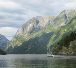 recognized us and the boat as we came in. Being familiar with our program, he had some very good suggestions for local activities including the construction of the world’s largest ocean-going Viking ship, 114 feet, to be built in modern times that was taking place right there in the port. He made the introductions and we visited the building site of Dragan Harald Fairhair, named for the Viking king that unified Norway into one kingdom and spoke to the skilled and passionate team working on this historic ship. Volunteers from around the world are being sought to train and participate in upcoming voyages. To learn more, visit their website at www.vikingkings.com/en.htm
The next day we met up with friend, Jostein Waage, for more sightseeing around the Haugesund area. We had a great day together visiting Alvadnes, once the ancient centre of power on the North Way, where the name Norway comes from, and where excavations are still going on. There is also a great heritage museum and Viking Farm called the Nordvegen History Centre where we learned about the history of the unification of Norway and Viking life from the knowledgeable staff who dress in period costume and 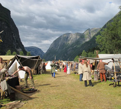 demonstrate crafts and food preparation from Viking times.
We also visited an old copper mine at Visne and learned that the copper used in the building of the Statue of Liberty came from here. Who knew?
From here we turned back to begin the voyage north up to explore Norway’s longest fjord, Sognefjord, at 120 km long, stopping in Bergen again to pick up Norwegian friends, Anette and Alf-Gunnar Øverbø and their teenage son, Martin, who we’d met cruising in the Mediterranean in 1998. They came aboard to sail with us down to Flam at the end of the Sognefjord.
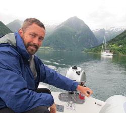
The trip through this most magnificent fjord with local friends that we’d made through a shared love of boats and the sea was the perfect conclusion to exploring the west coast of Norway and its fjords.
By Sheryl and Paul Shard
Award-winning filmmakers and sailing authors, Paul and Sheryl Shard, have been cruising internationally since 1989. 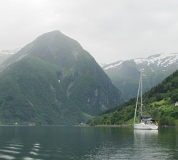 They are the hosts of the sailing adventure TV series, “Distant Shores”, that airs weekdays across Canada at 6PM ET/3PM PT on Travel and Escape Channel and includes episodes on their cruise of the west coast of Norway. Visit their website at www.distantshores.ca
