Baltic Odyssey
 “Did you sail all the way … from Canada?” My husband, David, and I were asked that question dozens of times as we circumnavigated the Baltic Sea during the summer of 2005. As people strolled by to see our port of origin, they’d spy the maple-leaf ensign and immediately strike up a conversation. Canada is popular in the Baltic; being Canadian is a first-class calling card.
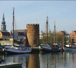
It started soon after our Hanse 411, Beyond the Stars, was launched at the Hanse plant in Greifswald, a medieval Hanseatic town in the former East Germany. The boatyard is conveniently located on the Ryck River, just a couple of miles from the Baltic. As we commissioned our yacht, a vintage tour boat, Stubnitz, would pass by, toot its horn and tell the tourists that Canadians had come “all the way” to sail these waters.
Victoria is our home port and we could’ve had our new yacht transported to Vancouver. But we opted to take delivery in Germany to realize a once-in-a-lifetime opportunity to explore a part of the world rarely cruised by those living on the Pacific. We wanted to follow in the footsteps of kings and warriors, industrious merchants and Teutonic Knights and learn about their powerful, intermingled history. We wished to sail the waters which the medieval Hanseatic League (a group of traders living in sea-linked ports on the Baltic and Europe who banded together to overcome their mutual problems of piracy and excessive custom fees), made the richest trading area in Europe. We longed to learn about the world’s biggest warships of their era whose top-heaviness had caused them to sink in minutes.
In early May we left Greifswald, well before the Baltic boating season that runs from late June to mid-August. We sailed north to Bornholm, which like so many places in the Baltic, has been fought over many times. Today, it’s resolutely Danish. When we arrived at Rønne’s 100 guest-berth marina, the sun peeked out over the sea of red-tile roofs flanking the coast. The core of this town of 15,000 is made up of 18th century homes. The narrow cobblestoned streets are lined with these small dwellings painted in cheerful wine-red or golden-yellow hues. Heritage rules require exteriors to retain their original architecture so you’re transported back to the era when Britain’s King George III reigned, French philosopher Voltaire wrote his satires, and Wolfe climbed the cliffs of Quebec to defeat Montcalm. Rønne’s rich nautical heritage is reflected in the lighthouse, herring smokehouses and marine decorations. We were greeted warmly by the harbourmaster, a harbinger of things to come throughout the Baltic.
We usually think of the Scandinavian countries as immune from war. But before today’s pacifist era, territorial and trade disputes among Danes, Swedes, Germans and Russians led to frequent war. That’s why Denmark chose to transform Christiansø and Frederiksø islands —just 10 miles north of Bornholm—into a mighty naval base. In 1684, 450 men began quarrying granite for the bastions; completing the fort took a century. But by the 1850’s, the fort’s military function had lost its relevance and tourists and now yachties come to admire the massive works and walk among the brooding eider ducks.
After a delightful visit to these Danish isles, we sailed north to Sweden, exploring the historic city of Kalmar with its famous Renaissance castle. We were moored along the dock when a teacher and a group of 10-year-olds walked by. She pointed to our flag and queried in Swedish, “What country does that boat come from?” “Canada,” the group sang out. “And what is Canada known for?” “HOCKEY!”
After stopping in Oland, a long, skinny island off the Swedish southeast coast where the Swedish royal family has its summer palace, we entered what the Swedes call skärgård, or “archipelago.” Swedes are immensely proud of the roughly 24,000 islands flanking the country’s east coast and whenever you meet sailors, they pull out charts to point out their secret covelet with its perfect anchorage.
Most islands show their coral-colored granite edges that curve smoothly into the bottle-green water. Many isles host cottages, usually painted a shiraz-wine colour, and flanked by a small hut containing the indispensable sauna. The islands are low and the waterways separating them are shallow. To aid navigation, the skärgård is remarkably well buoyed and local charts offer “preferred routes,” designed to help you avoid the rocks strewn liberally among the islets. As we discovered.
At 58°54 N, 018° 08 E, we gingerly motored through a narrow passage between Nattaro and Aspon Islands, intently watching the chart. Inching along at two knots, we turned sharply to avoid the submerged rock lurking in the channel’s centre. Crunch! Fortunately, we were able to back off the granite protrusion. It was a learning experience. Our Nobeltec electronic charts are superb, but we hadn’t remembered that the correct GPS location (the “green boat” on the charts) is a small circle at the port stern, not the bow. Combined with the slight time lag—when the GPS integrates with the satellite—this mistake had us on the rocks.
Without doubt, Stockholm is of one of the most beautiful capitals anywhere. The royal family has lived here for hundreds of years and has left a variety of palaces, many of which are now museums. The city is crisscrossed with waterways and bridges, supports more than 50 museums, and offers diverse cuisine and nightspots for every taste. Parks abound. You can get anywhere with public transportation.
Anchoring is forbidden in the city’s busy waterways, so we moored at the Navigationssällskapet where we stayed for several days. Of the many places we visited, the Vasa Museum was among the most enticing: it houses the royal warship Vasa, which after consuming a thousand great oaks and three years of labor, sank in Stockholm’s harbor during its maiden voyage in 1628. With ten sails hoisted, the richly decorated man-of-war sailed a mere 1,400 yards when a small gust made the ship heel. It gulped water through its gun ports and sank. Three-hundred thirty-three years later, Anders Franzén found the Vasa’s resting place. She was hoisted, preserved and today, she attracts more visitors than any other Swedish museum.
Another huge archipelago, the Åland Islands, lies between Sweden and Finland at the Gulf of Bothnia’s south end (60°N, 20°E). Before our Baltic voyage, we had only the vaguest impression of this collection of 6,000 islands, but the region’s reputation for wildness and beauty drew us to explore it extensively. So, on June 6, we set out to cross the Åland Sea. Although the day was gray, cold and blustery, we made good time sailing at over eight knots, arriving in Mariehamn, the largest town on the largest island by mid-afternoon. We docked at the East Harbor, found a friendly harbormaster and a sauna where we baked our chilled bones.
The Ålands were part of Sweden for centuries and people still speak Swedish; Finnish is their second language, appropriate as the islands have belonged to Finland since 1917. Despite a population of only 27,000, the Ålands are autonomous and hugely proud of having self-government, their own flag and highly collectible postage stamps. We explored the island, saw forts and castles, purple lilac hedges, classic burgundy-painted dwellings, a maritime museum full of ships’ figureheads, and a four-masted steel schooner, the s/s Pommern, now a museum. After all that civilization, we took off into the islands, which lie in shattered chains. The innumerable rocks flung among them mark the charts so thickly, the dense crosses resemble barbed-wire rims. It takes time to work out an appealing, safe passage.
We carefully wended our way into the Kökar group through slender passages. Fortunately, every twist was marked by range markers, cairns, beacons or buoys. Many islands are barren, windswept, chiseled and carved. Often, they resemble smooth skulls, a moonscape, the apricot-colored granite penetrated by dark streaks of gneiss: black licorice in bubble gum. Many an Ontario sailor having explored the North Channel would recognize the landscape.
After slaloming through yet more thousands of islands that lie off Finland’s south coast, we moored in Helsinki’s main harbour at the NJK yacht club, with its 19th century Russian architecture. We arrived just in time for Midsummer Night, the Finns’ biggest holiday. The shortest night of the year has been celebrated for centuries—some of its traditions predate Christianity. We teamed up with two sailors from Cork, Ireland, and travelled to the festival site on Seurasaari Island. All along the island’s coast, people gathered round the bonfires reputed to drive away witches and demons. As the sun slid lower (it never really set), the bonfires blazed, some on floating platforms. Everyone was merry—it was a superb family event.
From Helsinki, David and I sailed a glorious, nine-knot gennaker run to Tallinn, Estonia’s capital. The city’s large harbour is reserved for the ever-present ferries, tankers and freighters, so we moored at Pirita Yacht Harbour.
Tallinn exhibits layers of history through a mix of architectural styles and landmarks. The city’s outskirts are home to vast, Soviet-style apartment complexes—gray, drab bunkers. But Tallinn’s centre is included in the UNESCO World Heritage list. Surrounded by fortified walls more than a mile long, the city has an “Upstairs, Downstairs” division. In medieval times, the “upstairs” was reserved for nobles and clergymen, mostly Germans. The lower part was a Hanseatic “free town” with city rights bestowed by Lübeck, the League’s German headquarters. Populated by merchants and craftsmen, the town conducted its own affairs and developed trade policy in its trendy Town Hall. Today, the medieval streets and buildings are well preserved, colourful and filled with chic shops, restaurants and artist galleries.
Estonians, who’ve occupied these lands for millennia, are a proud, ambitious ethnic group having survived despite being overrun by Germans, Swedes, Danes, Poles, Russians and the Teutonic Knights, who converted them to Christianity with the sword. Estonia became independent in 1918, lost its autonomy in 1939, and finally—after the fall of the Russian empire—declared independence again in 1992. It has created a democratic state and joined the European Union in 2005. A plucky nation.
We spent several days seeing Tallinn and provisioning for the months ahead. In contrast to Sweden and Finland, groceries and alcohol are remarkably inexpensive. We then turned southwest toward the islands of Hiiumaa and Saaremaa. Few North Americans have ever heard of these sizable isles, but they’re surely worth visiting. In some ways, they resemble life 50 years ago—but watching the girls in their tight jeans and exposed belly buttons, we observed that “style” penetrates even the most isolated of places. Both islands are pastoral and boggy, with low-lying areas packed with reeds, whose stems do later duty in thatched roofs. Old-time windmills that can be turned by hand speckle the countryside. One evening, from the cockpit, we watched the sunset over the huge reed field edging the harbor. Suddenly, something spooked the dozens of blue herons asleep in the rushes, and they rose in unison, black wings flopping against the marmalade sky, screeching their grating cry. An unearthly sight.
We sailed west again toward Sweden to visit the Baltic’s largest island, Gotland, arriving in its main town, Visby (yet another Hanseatic city), during the annual “Medieval Week.” Every time we turned a corner in the narrow, curvy lanes, we saw people wearing flowing robes, long dresses, wimples and doublets, while toting leather wineskins. The ancient cobblestones and the splendid warehouses and residences going back as far as 1200 added to the illusion of a time warp. Making it even more realistic, we attended a jousting tourney, where 10 superbly trained horses and their brightly caped and plumed riders competed to catch rings, knock down obstacles and, yes, ram lances at each other. It was a splendid evening with much action, although organized in a way that no one was hurt.
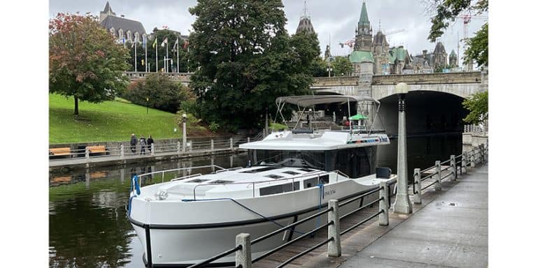
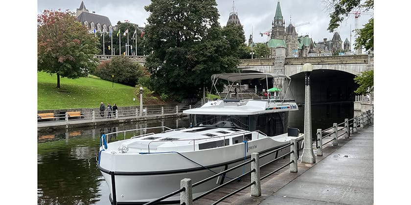
We completed our Baltic odyssey by traversing Sweden from east to west through the Göta Kanal. It’s a bit of a misnomer, because the voyage includes two canals, lakes and a river. We first transited the Göta Kanal, the country’s “blue ribbon,” constructed between 1819-1832. We crossed several lakes, entered the Trollhätte Kanal, and finally, motored down a swift-flowing river called the Göta. The surroundings change dramatically during the 210 nm voyage: a scenic inlet leads up to the canal’s eastern entrance; once you enter the canal, the landscape becomes flat farmland; lakes with their own clusters of islands are interspersed; and the last stretch shows off Sweden’s industrial strength. Parts of the journey are rapid; others are interrupted by the 64 locks and time waiting for automobile and train bridges to open. It’s also the first time we’ve sailed at an altitude of 92 meters.
It had been a delightful ten days floating through tiny villages and the rural serenity of Sweden’s heartland. The locks offered their own charm. Cruising salt water has its rewards, but our journey across Sweden’s internal waterways had given us a glimpse of Swedish history and a wider perspective on this Nordic nation. After Göteborg, we entered the Kattegat, then passaged south through the Øresund—the strait between Denmark and Sweden—on our way back to Germany. The return to Greifswald was almost like coming home. On one of its last voyages before winter, the Stubnitz blew its horn to welcome back the yellow Hanse with its maple leaf. Beyond the Stars was left in storage, awaiting the 2006 season of Nordic adventures.

