Round the Penders
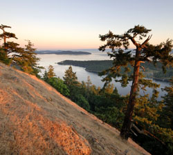
Join us on a tour of these “Sirens of the Salish Sea,” perhaps the most tempting of the Gulf Islands.
What is it about North and South Pender Islands, lounging smack in the middle of the Salish Sea, that makes them so alluring to boaters? The islands together comprise just 3,620 hectares and are home to only 2,300 residents. So why have they enticed skippers ever since their namesake, Daniel Pender, arrived in 1857 aboard his survey vessel HMS Plumper?
Steeped in history, fringed with pocket beaches and tempting tuck-aways, and offering ample amenities for boaters, the islands also have three perfectly spaced marinas, one marine park, 615 hectares of Gulf Islands National Park reserves (GINPR), two secluded freshwater lakes, three public docks, and more anchorages tucked into their shores than any of their neighbours.
Let’s begin at Otter Bay and cruise clockwise around these beautiful islands.
 Otter Bay
Boaters arriving from Porlier or Active passes to the north will probably be happy to make this busy hub their first port of call. They have the choice of tying up at Otter Bay Marina, tucked behind the bank of flags in Hayashi Cove, or anchoring. Matsuyama Company once flourished on the marina site, salting, packing and shipping herring to Asia before the property was confiscated by the government in 1942 under the War Measures Act. It continued operations sporadically until it burned down in 1956.
Loomed over by fractional ownership cottages, the marina has changed a lot over the past decade but still offers a warm welcome and full services to transient boaters. It’s also a great base for golfers keen to sink a few at the nearby Pender Island golf course, or for visitors using mainland or Vancouver Island ferries, which stop at the adjacent terminal.
 If you have children dying to splash in cold water or play on the beach on a hot day, there’s a sweet slice of public beach at the head of the bay; grab your towels and buckets and dinghy over.
While the bay is open to swells from passing ferries, anchoring is good. Whether you anchor or take a slip, you should visit Roesland, which has a new dinghy dock. Although the float is often crowded with park vessels, there is designated space for dinghies. Another plus, courtesy of GINPR, is the robin’s egg-blue building at the head of the ramp – a public toilet with flushers, a rare find on the thirsty Gulf Islands.
Roesland, one of the GINPR’s largest acquisitions at 230 hectares, is a wonderful place for all ages to explore. Although the bridge across to the islet has not been replaced, it’s easy to wade across in summer or cross at low tide. A short trail winds through the headland, lined by salal, twisting arbutus and firs, and culminates in a bench that is perfect for romantic sunset viewing.
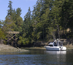 The Roes farmed here before they turned it into a rustic resort. It operated for over 70 years before its next owners, David and Florence Davidson, closed it in 1994. If it’s open, be sure to visit the museum located in the original Roe farmhouse, built in 1908. The larger log home, which now serves as the park’s field office, was built by the Davidsons.
Boaters in search of more exercise can visit Roe Lake, a short walk up the road to a well-marked trail through the forest. It’s possible to slip and slide all the way from the lake down into Shingle Bay, although walking around the lake is very pleasant and less onerous.
Swanson Channel
Heading southeast, you’ll soon notice old pilings in Shingle Bay, the site of yet another once-thriving industry – a dogfish and herring reduction plant that employed up to 20 men every summer. Built in 1926, it burnt down in 1958. Penderites 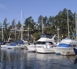 are delighted that the beautiful property and islet have now been added to the park system.
With ecological integrity as the goal, GINPR’s aim is to protect species in their environment and connect fragmented parts of protected lands, and this new park links with the Roesland property. A master plan is being developed and may include boat-in or hike-in camping and/or picnicking. Currently there’s a picnic table, a beach, old fruit trees, grasslands, and the reduction plant site to explore, but check the park website (see “Coordinates”) for current information.
The small grassy community park at the head of the bay has picnic tables, an outhouse, and a children’s playground, so it is tempting to consider putting down the hook, especially during the summer when no northwesterlies are forecast and Otter Bay is teeming. Don’t venture much past the pilings, however, as the bay shallows rapidly. You might also want to set both bow and stern anchors to face into the frequent ferry wake.
 Carrying on with your circumnavigation, the marina tucked behind the substantial breakwater just ahead is Thieves Bay, a private marina for folks living in the Magic Lakes subdivision. The turbulent waters here are great for fishing and killer whale viewing, so if you see a crowd on the banks, watch for those black fins and stay well clear.
Bedwell Harbour
Heading southeast and passing Oak Bluffs, skippers will soon find themselves rounding Wallace Point at the entrance to Bedwell Harbour, named after Edward Parker Bedwell, second master on the HMS Plumper. This is the site of Poets Cove Resort, a swishy fractional ownership resort complete with spa, five-star resort and bar, as well as a marina and the Penders’ only fuel dock. Bedwell is also the site of the most convenient Canada Customs dock for boaters crossing the border between here and the US San Juan Islands to the south.
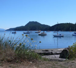 Skippers have many overnight options here. Poets Cove Marina has a slew of transient berths for boats of all sizes, and mooring ensures that all of the cove’s attractions are easily accessible. You can also grab a mooring buoy in nearby Beaumont Marine Park at $12 per night. Ashore at Beaumont, you’ll find picnic tables, a campsite, a new composting toilet and four “traditional” ones, and hikes up to the panoramic Mt. Norman viewpoint or down to the bridge between the islands.
Poets Cove offers shore access to boaters wishing to discover Greenburn Lake, a short but steep hike up from the fire hall on South Pender. This 69-hectare property was added to the GINPR in 2004. For awesome clifftop views, go right when you reach the lake, cross the ramp and follow the trail left, then watch for a trail going right.
Boaters also often enjoy strolling down the quiet road to South Pender’s more southern tip, a long but level 3.7 kilometres. Be sure to take the trail off to the right a block before road’s end, in order to enjoy Brooks Point, a very 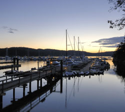 special place. Orcas can often be seen feeding here, as can seals, otters and birds. Brooks Point was acquired in 2001 and fundraising is on once again to help The Land Conservancy in its purchase of the adjoining land. Visitors can now walk to the tip of the island, enjoy an explosion of rare chocolate lilies in the spring, and ogle Washington’s Mt. Baker rearing out of the Strait of Georgia.
Back at the marina, there are a few other curiosities to check out. Look at the writing on the cliff adjacent to the docks. This historical graffiti was etched in 1905 by the crew of the Royal Navy survey vessel HMS Egeria. And if the sickly-looking tree in front of the hotel catches your attention, you might be interested to know that it’s a yew tree, considered sacred by several ancient religions. This yew may hide a grisly secret; see what you can find buried in its trunk and then see if you can get a staff member to tell the story of what might be buried under the tree. Believe what you will, several longtime employees have seen ghosts here.
Boaters can also anchor in Peter Cove, off the southern tip of North Pender, if they can find space among the mooring buoys, or off Medicine Beach on the North Pender side. Medicine Beach was acquired by Penderites in 1995 in order to save one of the Gulf Islands’ last remaining wetlands. Now a wildlife sanctuary, the eight-hectare reserve has no facilities other than a lovely beach and a short trail up to a viewpoint. It does, however, offer access to the island, and a liquor outlet and coffee shop can be found in the small commercial complex a half-block away.
Port Browning
When captain and crew are ready to move on, powerboaters will likely take the shortcut via the Pender Canal from the head of Bedwell Harbour to Port Browning, under the one-lane bridge that connects both islands. Currents can reach four knots through here. Proceed slowly – wave action is causing erosion and nearby Mortimer Spit is a favourite spot for kayakers. Dog walkers, families, and even hardy swimmers also enjoy this popular recreation site.
Excavations in 1957 resulted in the designation of the banks on both sides of the canal as a provincial heritage site. A later Simon Fraser University archeological dig uncovered thousands of artifacts which dated First Nations settlement back 5,000 years. An informative cairn can be found on the North Pender side, and some of these finds be seen at the Roesland museum.
But with just 28’ of clearance under the bridge at low water, most sailors will need to follow the longer route around South Pender, heading eastward past Camp Bay and between Teece Point and Blunden Inlet, and sailing down Plumper Sound to Port Browning.
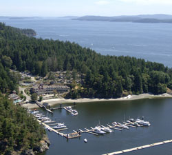
This is a favoured cruising stopover, offering overnight moorage choices, proximity to the islands’ commercial hub, the Driftwood Centre, a chance to meet the locals and enjoy nightly specials like “Turkey Tuesday” and “Pizza and Beer night” at Port Browning Marina’s popular pub, and a great beach. In addition to the marina, there is 400’ of dock space at the public wharf on the harbour’s east side. This is the home base of Station 20 of the Royal Canadian Marine Search and Rescue.
There’s also good anchorage close to the beach that offers shelter from all but southeast winds. Hamilton Beach is the best on the Penders, home to the annual polar bear swim and starting point for the popular August Round-the-Penders yacht race.
Hope Bay
After a night or more in lively Port Browning, it’ll be time to round Razor Point and continue northwest on Plumper Sound a short distance to Hope Bay. Three hundred feet of public moorage can be found at the Hope Bay Harbour Commission's wharf at the west entrance to the bay. However, it’s open to wakes and weather from the east so it’s not the best of overnight spots. Beyond the docks, the bay almost drains at minus tide. There are also two mooring buoys for visiting boats.
Treat Hope Bay as a perfect stop for breakfast, brunch or lunch at the popular Hope Bay Café, and a browse around the shops. This attractive commercial complex has grandly risen from the ashes after it was gutted by fire in 1998. The burnt-out store, built in 1912, was rescued by a group of 27 Penderites who completed their restoration in 2005. The property was later sold to Pender realtors Sherrie and Sam Boyte. Visitors will find an excellent goldsmith, a must-visit artists’ co-op – the Red Tree Gallery, a real estate office, home furnishings store, and many other businesses in this beautiful and historic part of Pender.
Upon leaving the bay, you may soon notice the broken red bricks onshore. They gave their name to the tiny bay here. Bricky Bay was the site of another flourishing industry in 1912 and is now one of the Penders’ 25 public beach accesses. The Coast Shale Company occupied 50 acres here with a shale pit, railway track, mineshafts and accommodation for 75 men before it closed down in the early 1920s.
Tranquil Davidson Bay (Clam Bay to the locals) is a good spot to drop temporary anchor and perhaps even a crab trap. The substantial dock here is private. Buildings on the beach and inland are part of what was once the Clam Bay Farm resort. It’s suitable only for temporary anchorage.
Port Washington
Around Stanley Point, Grimmer Bay and Port Washington's public docks come into view. There’s 250’ of dock space here. The bay, named after the first postmaster, Washington Grimmer, is where the “school boat” picks up students en route to high school on Salt Spring Island. Port Washington is another good temporary stop, with possible overnight anchorage in the bay. If you tie up, favour the more protected south dock.
Now it’s decision time. Circumnavigation complete, are you really ready to leave these friendly islands? Why not chat to the locals and find out what’s happening at the winery, the farmers’ markets, the community centre, the artists’ galleries, Poets’ Cove, the church hall, the pub, the Legion? On the Penders you can be sure of two things: something fun is always happening somewhere, and getting to where the action is will never be a problem.
Look for the signs placed at strategic places around the islands – they are recognized places for people to wait if they require a lift. Erected in 2008 by Moving Around Pender, an alternative transportation society, they were the brainchild of Penderite Barry Mathia. They offer visitors a convenient way to really experience life on the Penders.
Local Knowledge
• A bridge does not one island make. You can always detect visitors – they're the ones who refer to “Pender Island.” While it's true that for thousands of years the Penders were one island, joined by an isthmus the Coast Salish called “helisen” (lying between), the canal was dug in 1902 to allow the ferry Iroquois a quicker transit from Hope Bay to Sidney. The canal cut nine miles off the route and made the trip safer, although in an ironic twist of fate, the Iroquois foundered off Sidney on April 10, 1911 with considerable loss of life. In 1955, the present one-lane bridge was built to connect the two islands.
• Rivalry. "There used to be disharmony between the settlements of Port Washington and Hope Bay," recalled David Davidson of Roesland, who knew the Penders since 1926. "Port Washington was Anglican, Hope Bay was United. Hope Bay parents would sometimes remonstrate with their children, 'If you're not good, I'll send you over to Port Washington.'" For years the stores in both communities competed to be the local post office and general store and to have the ferry dock, each winning and losing more than once. Over the years, the stores have been abandoned, rebuilt and offered for sale, but just now Hope Bay is winning. The Port Washington store has sat empty for years.
Coordinates
• Otter Bay Marina. Open year-round with 15, 30 and 50-amp power, laundry, showers, pool, berths for any length craft, 80 slips, seasonal bistro. Close to ferry and golf course. www.otterbaymarina.ca.
• Port Browning Marina. Laundry, showers, seasonal store, camping, Wi-Fi, kayak rentals, café and pub. Close to Driftwood Mall. www.portbrowning.com.
• Poets Cove Marina. 110 slips, 30-amp power, Canada Customs, marine store in season, year-round restaurant, bar, spa, pool, hot tub, resort. www.poetscove.com/site/marina.html
• Southern Gulf Islands Harbours Commission. Wharfingers: Port Browning – Claude Kennedy, 250 881-2019. Hope Bay – Peter Binner, 250-813-3321. Port Washington – Rod MacLean, 250-629-6111.
• Canada Customs at Bedwell Harbour. Staffed May-August from 0900 to 2000, September 0900 to 1700. Off-season, skippers must report to Sidney Customs. Call 1-888-226-7277.
• Gulf Islands National Park Reserve. www.pc.gc.ca
• General Pender Island Information: www.penderislandchamber.com.
PHOTO CAPTIONS
Photo 1 – Mt. Norman, above Beaumont Marine Park, offers spectacular views of the Gulf Islands. Kevin Oke Photography
Photo 2 – Hope Bay is a perfect day stop, with a popular café, an artists’ co-op, and other shops. Cherie Thiessen Photo
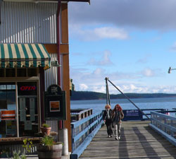
Photo 3 – Browning Harbour public dock offers 400’ of visitor moorage. Cherie Thiessen Photo
Photo 4 – The Pender Canal offers a shortcut between Bedwell Harbour and Port Browning, but 28’ clearance means most sailboats can’t make it under the bridge. Kevin Oke Photography
Photo 5 – Otter Bay Marina offers full-service moorage close to Active Pass. Kevin Oke Photography
Photo 6 – Poets Cove Resort.
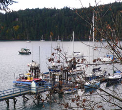
Photo 7 – Port Browning offers anchorage, a popular marina and a public dock. Cherie Thiessen Photo
Photo 8 – A stunning Gulf Islands evening at Poet’s Cove Resort, Bedwell Harbour. Kevin Oke Photography
By Cherie Thiessen
