A Taste of Superior: The East Shore
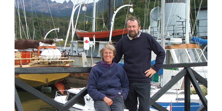
By Jennifer M. Smith, author if Green Ghost, Blue Ocean
Our 2020 cruise in the North Channel was too good for a one-off, so, when a career move provided downtime in summer 2021, we sailed north for more.
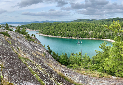
Sinclair Cove – Green Ghost at anchor
Departing from Penetanguishene, nostalgic hearts insisted upon stops in favourite Georgian Bay anchorages, while adventurous spirits had us exploring new areas too. In two weeks, we’d made Killarney and after cruising that area, we arrived in Little Current where we could fill up and empty out, then head off to see more of the North Channel.
We’d gone as far as the Benjamins before, so we made these islands our starting point. It’s an overly popular spot, but so beautiful, that we think it’s a must-see. We stayed two nights and departed late on our third day for the pleasure of waking up in undiscovered territory.
 Heading northwest, we navigated the narrow channel at Little Detroit and dropped our hook off Green Island. After a restless sleep through thunderous heavy rains, we awoke uninspired by the overcast sky. Our new view didn’t measure up. We thumbed through our guidebook. We needed a plan.
“The last commonly visited island is Turnbull Island,” I read aloud from our PORTS guide.
“That can’t be right, that’s only fifteen nautical miles from here,” Captain Nik replied.
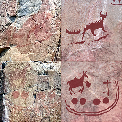
Agawa Rock – Pictographs
We couldn’t be at the end of the popular cruising grounds already, could we? With only three more pages left in the guidebook, we suspected the answer was yes. With only sixty miles of North Channel out in front of us, and two months of freedom yet to cruise, we needed more runway.
The day brightened as it unfolded. We cruised west along Whalesback Channel. A bald eagle soared over John Island. Our spirits lifted with the rain. The sun-lit scenery at the western end of the channel was beautiful, and at mid-day, we tucked in alongside two other boats in cozy Long Point Cove, much happier with our view.
 The couple from M/V Doldrums dinghied over. When we learned they were from Thunder Bay, a lengthy conversation about favourite anchorages ensued. That was all it took. From some enthusiastic sharing with fellow cruisers, a Superior plan was born.
Agawa Rock – Pictographs
With our hearts set on “the big lake they call Gichigami”, we committed ourselves to some big mileage. Putting in a long day in dreadful weather but good wind, we sailed westbound to Thessalon. From there, we crossed to St. Joseph Island and turned up the St. Mary’s River. An anchorage under East Neebish Island gave us adequate protection from northwest winds for a night. Another twenty-five miles upriver, and we were in Sault Ste. Marie, tied up on the seawall at Roberta Bondar Marina. After two days of the requisite boat chores, we were ready to go.
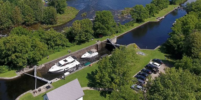
The single lock for pleasure boaters on the Canadian side of the river was a cinch to traverse. By calling “VDX23, Canadian Canal” on Channel 14, we spoke to the lockmaster at opening time, 9 a.m. With a single line at bow and stern loosely looped around the vertical lines in the lock, we had a smooth ride up in the slow-filling chamber. When the gates opened, we crossed the threshold to Superior adventure.
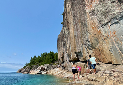
Windless adventure mind you. We motored across Whitefish Bay in the heat of the August sun, cooling ourselves with the anchor wash-down hose at the bow. It was forty-one miles from the locks to Batchawana Bay, and we covered the same distance again the following day, past Montreal Island to the clear water of stunning Sinclair Cove.
Here we took a day off to search out the 400-year-old Agawa Rock pictographs in Lake Superior Provincial Park. The famous archaeological site can be accessed by trail from the beach or by watercraft. We chose to dinghy around, finding the location easily by the number of hikers on shore.
 Light southeast winds and a marked southwesterly swell made for rolly conditions on a half-day motor sail north around Cape Gargantua to Indian Harbour. In the afternoon, we set off to explore on our SUP boards. In a shallow inlet north of the anchorage, we paddled against a current toward the sound of a waterfall. We stepped off our boards in calf-deep water to see if we could wade up the small stream to the source of the sound. Oddly, our boards began to drift ahead of us. When I looked down through the clear water, leaf litter on the bottom suddenly began to tumble across the sand upstream. A small sandbank, bare moments earlier, was quickly submerged. It wasn’t until later that evening that we learned the name of the phenomenon. We’d experienced a seiche (pronounced SAY-sh), a water level fluctuation caused by a standing wave oscillating in a body of water. They are most readily observed in constricted inlets, just like the one we were in.
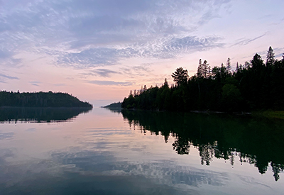
Brule Harbour – Evening Peace
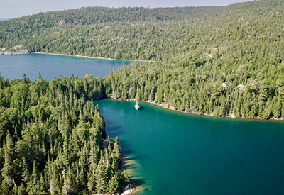
The commercial fish boat, Llark, joined us in the anchorage for the night and woke us early motoring past at 6:15 a.m. We enjoyed the lazy man’s start, passing the fishermen at work mid-morning, their brightly flagged markers easy to see against Superior’s deep blue. We swung in under the high cliffs of Old Woman Bay and arced past the shoreline dotted with beach-goers. Less than fifteen miles north, with a bow watch and a central channel position, we navigated through the narrow deep entrance to Brule Harbour. We lowered the bow anchor then, stern-tied to shore in the northwest corner of the cove, amazed to find ourselves the only boat in this perfect spot, a lake within a lake.
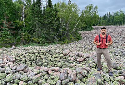
 We’d read that ancient structures called Pukaskwa pits (pronounced Puck-a-saw) could be found on the terraced shoreline on the mainland. We landed our dinghy in a safe spot, and with a bit of effort boulder hopping and bushwhacking, we found these archaeological mysteries: low-walled elongated oval depressions in the ancient cobblestone beaches. Whether these simple structures were used as temporary dwellings, food caches, or hearths is not known. There by the grace of our diesel engine, our motorized dinghy and our GPS, it was humbling to observe these pits thought to be built by the Blackduck peoples 400 to 900 years ago.
Brule Harbour – Drone Shot
In the morning, a local beaver escorted us out through the cedar-green water of the channel.
We headed west across Michipicoten Bay to Ganley Harbour. Warm southerlies brought moist air over sixteen-degree water resulting in fog. With visibility less than half a mile for most of the crossing, we were glad to have radar, GPS and AIS. We were also happy to find intermittent cell phone coverage mid-bay allowing us to gather weather information that told of a one-day reprieve from approaching near-gale conditions.
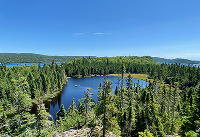
 Inside the well-protected Ganley Harbour suddenly-summer-again conditions invited a paddle around the anchorage and a woodland walk along a moose-trodden path to a landlocked lake.
Ganley Harbour
We decided to cover the distance to Otter Cove before hunkering down to wait out the coming adverse weather. Conditions were uncomfortable with three- to four-foot waves and no wind to match the sea state. In the half-mile visibility, we dubbed the month “FAugust”, traversing the final twenty miles northwest running “what ifs” through our minds. What if the fuel is shaken up and sludge in the tank clogs the filters and stalls the engine? It was a sobering thought with no wind for sailing, in thick fog, and big seas on a lee shore. It was also daunting to contemplate that we had no cell phone coverage, no weather reception on our VHF, and we’d seen only one other boat all week. Next time, we thought, we’ll have a satellite phone for added safety.
At Otter Head, like magic, Otter Island appeared out of white air. Our concerns disappeared with the fog as we navigated into Otter Cove. It was easy to pick a spot: we were the only boat there.
 A dinghy ride to the head of the cove revealed beaver, geese and bald eagles, but no moose as we’d hoped. We poked around an old cottage and investigated an inlet where the sound of a waterfall prompted a hike to the source. We ate dinner in the cockpit in sunshine and later, in darkness, we marvelled at the brightness of the stars.
Pukaskwa Pit near Brule Harbour
The following day was perfect for a shore excursion so we loaded up the dinghy and made for Otter Island where one of the largest known sites of Pukaskwa Pits is located. Meter-high swell coming in between the headland and the island made for a wild mile and a half ride. We landed on the northeast side, in the lee of the island, carefully tying the painter to a fallen birch tree and using a stern anchor to keep the dinghy off-shore, thinking, should one line chafe through, we could count on the other.
We hiked through dense bush using Nik’s Garmin watch as a compass and checking our position frequently. Even so, we emerged on the southwest shore having never found the pits. Undeterred, we plunged back into the forest, stumbling around quite a while before finally coming upon the large archaeological site. Success at last! At the end of our excursion, Nik’s watch indicated that in our three-hour walk we’d covered only about a mile. Did I mention it was very dense bush?
For a change of scenery, we moved Green Ghost north, navigating slowly through the unnerving rocky entrance into Old Dave’s Harbour, at one point seeing only two feet below our keel. We dropped the hook in thirty feet of water and backed down over a rapidly shoaling bottom to stern tie to the cement wharf.
 A walk to the lighthouse was an enjoyable outing. A dinghy over to the old fishing station on the small island across the anchorage also provided some good entertainment. Nik poked around old buildings and read forty-year-old magazines while I revelled in berry picking amid patches of blue abundance. With whipped cream and a crumble crust, we had sweet treats for dessert that evening, celebrating the apogee of our Superior cruise.
Otter Island – View South
On our morning departure, we swung by Cascade Falls but with a strong westerly still blowing, the lee-shore conditions were not ideal for a photo stop, so we turned and headed south for Ganley on a bumpy ride.
For the next week, we retraced our steps enjoying each anchorage for a second time. On our sixteenth day, we were back in “The Soo”, our senses filled with the magnificent and challenging Superior.
Bonnie Dahl’s exceptional guidebook, Superior Way, had prepared us, stating frankly that the northern half of Lake Superior’s eastern shore is one of the most remote and challenging areas in the lake to cruise. While the anchorages we visited were both beautiful and well protected, travel between them was on open water along a shoreline hammered by sizeable seas. Fog added a further challenge to our cruising, as did the lack of access to weather information. In remote Superior, it was impossible not to feel a heightened awareness of our isolation, alone in nature. But perhaps, that’s why we go.