The passages north of Desolation Sound Part 2
Nov 8, 2018
Part two in CYOB West’s survey of the major routes north of Desolation Sound where some of BC’s best cruising grounds lie just beyond a series of challenging tidal passes.
The series of passes from the Yucultas (pronounced “uke-la-taws”) to the end of the Dents stretches over four miles but transit for most boats should take only 30 to 45 minutes. If you are northbound to the Yucultas, try to arrive just as the flood is turning to slack – this will enable you to ride the ebb by the time you reach Gillard Passage.
The predominant characteristic of these rapids is the choppy water and turbulence that start south of Kellsey Point on Stuart Island and continue to Gillard Passage. This channel is deep and fairly wide, with the least turbulence in mid-channel right up to Whirlpool Point.
Slower vessels arriving at the end of a flood can take advantage of a back eddy along the Stuart Island shore up to Kellsey Point. From there, if conditions are safe, cross to the Sonora Island side of the channel (where the north-going ebb current begins early) and continue to Gillard Passage.
The Yuculta Rapids are a sort of catch basin for debris flowing from the other passes. Some pieces of wood may be submerged below the top layer of fresh water that flows from Bute Inlet. Debris not buoyant enough to be supported by this freshwater layer can sink to the denser saltwater three to six feet down, so keep a sharp eye for deadheads and other wood bobbing just below the surface.
Strong currents really get under way in the area opposite Whirlpool Point (or Outhouse Point, as locals call it). Three streams converge on the flood to make the area opposite Big Bay one of the most turbulent and confused pieces of water anywhere on the BC coast. Combined with a mix of fresh water from mainland rivers and streams, especially in late spring, these currents and overfalls are impressive.
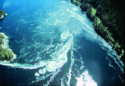
 Because the water also turns 90 degrees between Yuculta Rapids and Gillard Passage, large whirlpools and holes form east of Gillard Island during flood conditions. The area southeast of this island is especially dangerous during large flood tides, as is the area between Jimmy Judd and Gillard Islands. The flood set is very pronounced onto the west end of Jimmy Judd, and this area between the two islands is also where the current will be strongest.
We usually like to be in Gillard Pass at the onset of the ebb but if you find yourself still battling a lot of flood current, an alternate route north is to proceed across the mouth of Big Bay and navigate east of the 15.8-metre sounding in Barber Passage, which runs slightly slower than Gillard Passage.
Proceeding north from Jimmy Judd Island, arrive with Little Dent Island to starboard and the ebb under way. On a strong flood, Devils Hole, a turbulent and aerated section of water south of Little Dent Island, can be a frightening spot, but on an ebb the stream is much more consistent because there is nothing to deflect the flowing water. If you find yourself riding a faster ebb than you have planned, stay in the middle of the pass to avoid the set to Tugboat Passage with its dangerous rocks.
Once you are clear of the Dent Rapids – that is, west of Little Dent – steer north of the shoal patch marked as 6.4 metres depth about a half-mile northwest of the QR light on Little Dent. There can be lots of turbulence here on an ebb.
Transiting the Dents southbound is usually an easier proposition; they turn to flood 15 to 25 minutes before Gillard Passage, enabling you to ride the early flood south. Devils Hole should not present difficulties for most powered boats early in a flood.
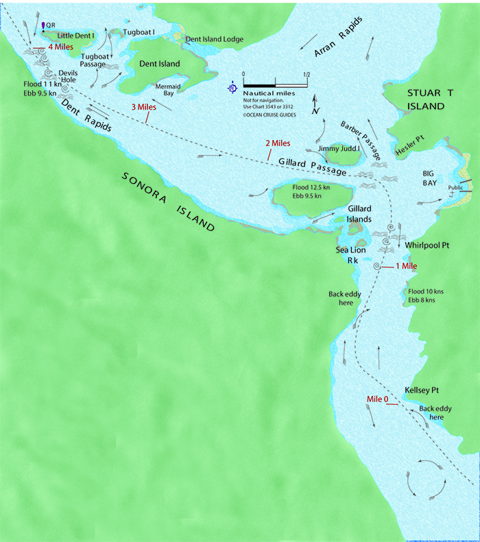
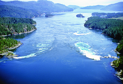
The main difficulties at the Dents occur during strong floods as a result of the tremendous wrenching Little Dent Island gives the tidal stream at the northwest tip of the island. This forces a major deflection of current over to the Sonora Island shore which in a large tide gives tardy southbound boaters (such as ourselves on one occasion) the appearance of the edge of a waterfall as it actually drops onto the back eddy east of the QR light. If you are going with the flood, favour the Sonora Island shore until you are well past Dent Island.
The area around the Yucultas and the Dents offers numerous spots to wait for the next slack or spend the night. They include Big Bay public dock on Stuart Island, the Dent Island Lodge Resort on the small islands east of Dent Island (a reservation for overnight moorage is recommended) or the anchorage in Mermaid Bay.
By William Kelly
Photos and maps by Ocean Cruise Guides
