Heritage Pt 1 – Historical Tall Ships Tour Provides Opportunity To Revisit Great Lakes History
MIDLAND/PENETANGUISHENE LOCAL HERITAGE – MELDING THE OLD WITH THE NEW
Article: John Jamieson Photo: Huronia Museum
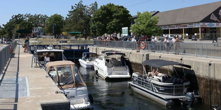
This year there will be several events commemorating the 200th anniversary of the second year of the War of 1812. The Huronia Museum’s focus will be the war on Lakes Huron and Michigan, as the struggle for control of these lakes had the greatest impact on Huronia. The Museum’s newest exhibit “The Birth of Simcoe County and the War of 1812″ introduces the subject and shows the impact of the War on the founding of the town of Penetanguishene. This display gives a good background on the part that the local area played in the events that took place on the Lakes before, during and after the War. The tall ships will also visit the Lakes to commemorate the Anniversary and will re-enact naval battles on the Lakes. Some of these ships will visit Midland and Penetanguishene towards the end of August. That is the old part. The new will take place on the 3rd of May at the North Simcoe Recreation Centre at the annual Museum Heritage Dinner, where the guest speaker, Steve Killing, a local ship and yacht designer, will tell us about some of his designs and the search for speed under sail. Believe it or not, the subjects are all inter-related. Steve designed H.M.S. Bee, the historic 70′ schooner that is based at Discovery Harbour, Penetanguishene along with several reproductions of historic small craft for the Toronto Pier Museum and Discovery Harbour.
Water transport was the main method of moving large quantities of goods, provisions and people in most of Upper Canada during the war as roads were virtually non-existent. Those that did exist were often not suitable for anything larger than a horse and small cart. Trade was the main driver for these routes. In the Upper Lakes the fur trade was king and depended on the maintenance of a link between the traders in the east and the gatherers in the west as each depended on the other for supplies and furs. This interdependence became even more important with the start of the War as the few regular British troops in the area depended on native warriors to augment their numbers. The fur traders used the Ottawa River and canoes to move goods and furs to and from Montreal to Georgian Bay and then to the west. Once on the lakes, they were able to use larger craft such as trade canoes, bateaux (a 30 to 35 foot flat bottomed boat resembling a dory) or small North West Company schooners to trans-ship cargo between the western ends of Lakes Huron, Michigan and Superior to the collection points for the return trip by canoe to Montreal. The passage from Niagara via Lake Erie, Detroit/St. Clair River to the upper lakes was slower but was used by small ships to transport heavier supplies to the trading posts.
The Seven Years War between France and Britain ended in 1763 and with it, France lost most of her North American possessions. This gave the British and their First Nations allies unchallenged control of the Great Lakes until the end of the American Revolution. Included in the French territory ceded to the British was the strategically important fort at the Strait of Mackinac, between Lakes Michigan and Huron which controlled the flow of trade to the west. The Treaty of Paris ended the American Revolutionary War in 1783 and established the border between the United States and British North America. The line ran through the middle of Lake Huron but became a little more vague when it got into Lake Huron’s North Channel and the Saint Mary’s River. It did put Fort Michilimackinac on the American side but as the exact location of the boundary remained under dispute, the British remained there until1796 when the garrison moved to St. Joseph Island.
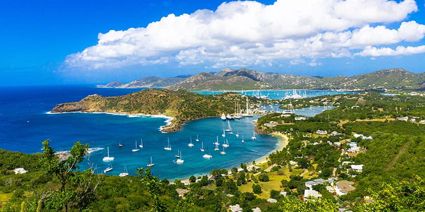
Although the Treaty of Paris established a boundary line of sorts between the United States and British North America it did not create an easy peace between the two territories. The far sighted first Lieutenant Governor of Upper Canada, John Graves Simcoe, saw the need to strengthen Upper Canadian defences in the event of an attack from the south. He toured Upper Canada to inspect its defence system In November 1793 and was impressed with the geography of the Penetanguishene area. The harbour, with its narrow entrance could be easily defended by well placed batteries and the deep bay would be an ideal location for a naval dockyard. He noted that if a naval base were established here, it would not only serve as a centre of operations from which to control the Upper Lakes and the fur trade, but also as a vital protected transport link from York to the northwest in the event of war. The Crown negotiated a treaty to purchase the land surrounding Penetanguishene Bay with five local Ojibway chiefs in 1795. Although it was ratified in 1798, nothing more was done to develop the site until January 1812 when the town plot was laid out as it was considered that a town would inevitably result from the nearby military presence once a naval base was constructed. Construction did not start on the dockyard until the fall of 1814.
The British were no longer able to transport goods to the Upper Lakes by water via the lower lakes after the American Navy gained control of Lake Erie in September 1813. This left the old route from York to Lake Simcoe and then across to the Nottawasaga River as the only alternative to maintain a supply route from York to Fort Michilimackinac until the construction of the Penetanguishene Road was begun towards the end of 1814. This new road provided a land route from Penetanguishene to Lake Simcoe where it connected to the existing route south to York (Toronto). However, once peace was declared, it was thought there was no longer any need for major defensive works at Penetanguishene. Construction was stopped and the site was abandoned.
Following the War, it was recognized that a proper naval base was essential to supply and defend the Upper Great Lakes in case of future hostilities with the United States. As a result, the existing Royal Navy’s base of operations for the Upper Lakes at the mouth of the Nottawasaga River was moved to Penetanguishene in 1817, to take advantage of the superior harbour. By 1820, over 20 vessels were based at Penetanguishene, supported by more than 70 personnel, including officers and their families, sailors, soldiers, and civilian workers. As anticipated by the earlier town survey, the naval base provided the impetus for settlement in both the surveyed town plot and further south along the Penetanguishene Road. Cash was still rare in rural Upper Canada at this time and most people used the barter system for goods and services but the fact that the military paid cash attracted settlers to this part of Simcoe County. Those who supplied goods and services to the naval establishment tended to settle along the Penetanguishene Road for easier transport of their goods.
Although the Treaty of Ghent ended the War of 1812 and restored territory and boundaries to the pre-War state, the old boundary dispute in the northern part of Lake Huron still had not been resolved and had to wait until 1822 when the Boundary Commissioned established the line. Although Fort Michilimackinac had been captured from the Americans in 1812 it had to be returned to them under the terms of the Treaty of Ghent. As a result the British garrison withdrew to Drummond Island and established a fort there in 1815. When it became apparent that the Boundary Commission was going to draw the line, with the Island on the American side, the garrison and traders and their families were moved to Penetanguishene when the fort was abandoned in 1828. The Crown compensated the traders by giving each of them 20 acres along Penetanguishene Bay adding French and Ojibway language and culture to what had previously been a British settlement. An additional influx of settlers was experienced in 1835 when British army veterans were settled on five acre lots on what was then known as “The Lines” and is now known as Church Street. The cleared land that resulted from the massive migration fuelled the growth of the village.
Part 1 of a Series of 3 Articles
Read Part 2 of Heritage Series | Read Part 3 of Heritage Series
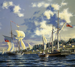
Photo Caption: This painting by renowned marine artist Peter Rindlisbacher depicts Penetanguishene Harbour in 1817 is on display at the Huronia Museum Midland.